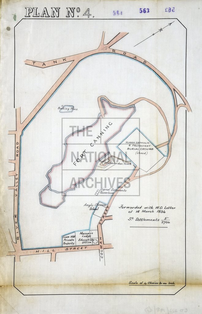
Fort Canning and surrounding area, Singapore
Date:
1884
Reference:
MPG 1/885 (4)
Creator:
Maps and plans extracted to flat storage from records of the Colonial Office
Catalogue context:
7 items extracted from CO 273/198 . 7 plans of Singapore. (1) Plan of harbour and roadstead. Scale: 6 inches to 1 mile. Compass indicator. Compiled from surveys made on the spot by Captain Jekyll RE and from local plans. (2) Plan of Beaconsfield. The plan shows Outram Road and site of powder magazines. Scale: 1 inch to 4 chains. Compass indicator. (3) Plan of Mount Palmer. The plan shows Anson Road, Joss House and Parsee tombs. Scale: 1 inch to 1 chain. Compass indicator. (4) Plan of Fort Canning. and surrounding area, bounded by River Valley Road, Tank Road, Colman Street and Hill Street. Scale: 1 inch to 4 chains. Compass indicator. (5) Plan of Fort Canning and surrounding area, bounded by River Valley Road, Back (sic) Street, Coleman (sic) Street and Hill Street. Reference table. Scale: 1 inch to 4 chains. Compass indicator. (6) Plan of military land at Pearl's Hill, showing land at present in charge of the War Department and additional land proposed to be handed over to the War Department. Reference n...
Categories:
Maps and plans; Overseas
Subjects:
Archives and libraries; Armed Forces (General Administration); Asia; International; Maps and plans; Prisons
Topics:
Crime, courts and justice; International trade and affairs; Land and buildings; Military and war
Period:
Victorians
Places:
Singapore
Copyright information:
Copyright clearance for publication is not required, except in the case of documents in third-party copyright.
Usage terms:
https://www.nationalarchives.gov.uk/documents/information-management/use-of-tna-materials.pdf