Trade Map of South Africa
Date:
1882
Reference:
MPG 1/927/1
Creator:
Maps and plans extracted to flat storage from records of the Colonial Office
Catalogue context:
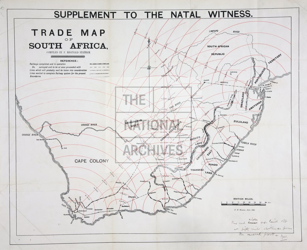
'Trade Map of South Africa compiled by F Reginald Statham', showing completed and contemplated railways; distance arcs, laid off at 50 mile intervals, from Cape Town, Durban, Lourenço Marques and other places. Reference table. Scale: 1 inch to about 66 miles. Compass indicator. Drawn by F.W. Weierter, 1882. The map was prepared as a supplement to the Natal Witness .
Categories:
Maps and plans; Overseas
Subjects:
Africa; Archives and libraries; International; Maps and plans; Railways; Trade and commerce
Topics:
International trade and affairs; Land and buildings; Transport and travel
Period:
Victorians
Places:
Africa
Copyright information:
Copyright clearance for publication is not required, except in the case of documents in third-party copyright.
Usage terms:
https://www.nationalarchives.gov.uk/documents/information-management/use-of-tna-materials.pdf