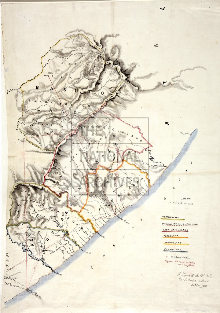
Kaffraria Proper (Transkei) and Basutoland (Lesotho)
Date:
1883
Reference:
MPG 1/927/2
Creator:
Maps and plans extracted to flat storage from records of the Colonial Office
Catalogue context:
South Africa: Map of Kaffraria Proper (now Transkei) and Basutoland (now Lesotho), showing proposed military frontier roads; boundaries of Tembooland, East Griqualand, Pondoland, Basutoland and Fingoland; positions of military stations; and distances. Reference table. Scale: 1 inch to 20 miles. Signed by F. Tyrrell, Lieutenant Colonel RE, MS Corps retired, October 1883.
Categories:
Maps and plans
Subjects:
Africa; Archives and libraries; International; Maps and plans
Topics:
International trade and affairs; Land and buildings
Period:
Victorians
Copyright information:
Copyright clearance for publication is not required, except in the case of documents in third-party copyright.
Usage terms:
https://www.nationalarchives.gov.uk/documents/information-management/use-of-tna-materials.pdf