Outer defences of St John's Newfoundland Canada
Date:
1780
Reference:
MPG 1/1002 (2)
Creator:
Maps and plans extracted to flat storage from records of the Colonial Office
Catalogue context:
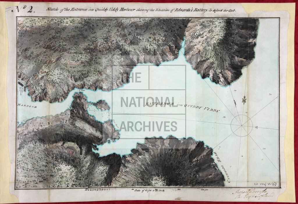
5 items (enclosures in Governor Edwards' despatch of 1 August 1870) extracted from CO 194/35 (pages 52-60). Five maps of the outer defences of St. John's, Newfoundland (now in Canada) by Robert Pringle, Chief Engineer, Newfoundland. High land and woodland in relief. (1) 'Sketch of the Lines and Batteries to defend the Pass from Quiddy Viddy Pond'. Scale: 1 inch to 70 feet. Marked as No. 3 in manuscript. (2) 'Sketch of the Entrance into Quiddy Viddy Harbour shewing the situation of Edwards's Battery to defend the Gut.' Scale: 1 inch to 60 feet. Compass Rose. Marked as number 2 in manuscript. (3) General map of Cuckolds Head and Quidi Vidi Pond. Scale: 1 inch to 400 feet. Compass rose. Marked as number 3 in manuscript. (4) 'Sketch of Hay's Battery, erected to defend an Important Pass in the Road from Petty Harb r to. St John's'. Scale: 1 inch to 100 feet. Not numbered in manuscript. (5) 'Sketch of Cuckolds Cove, with the Lines and Batteries to prevent a landing'. Scale: 1 inch to 40 feet. Compass rose. Mark...
Categories:
Maps and plans; Overseas
Subjects:
Americas; Archives and libraries; Forestry; International; Maps and plans
Topics:
Agriculture and environment; International trade and affairs; Land and buildings
Period:
Empire And Industry
Places:
Canada
Copyright information:
Copyright clearance for publication is not required, except in the case of documents in third-party copyright.
Usage terms:
https://www.nationalarchives.gov.uk/documents/information-management/use-of-tna-materials.pdf