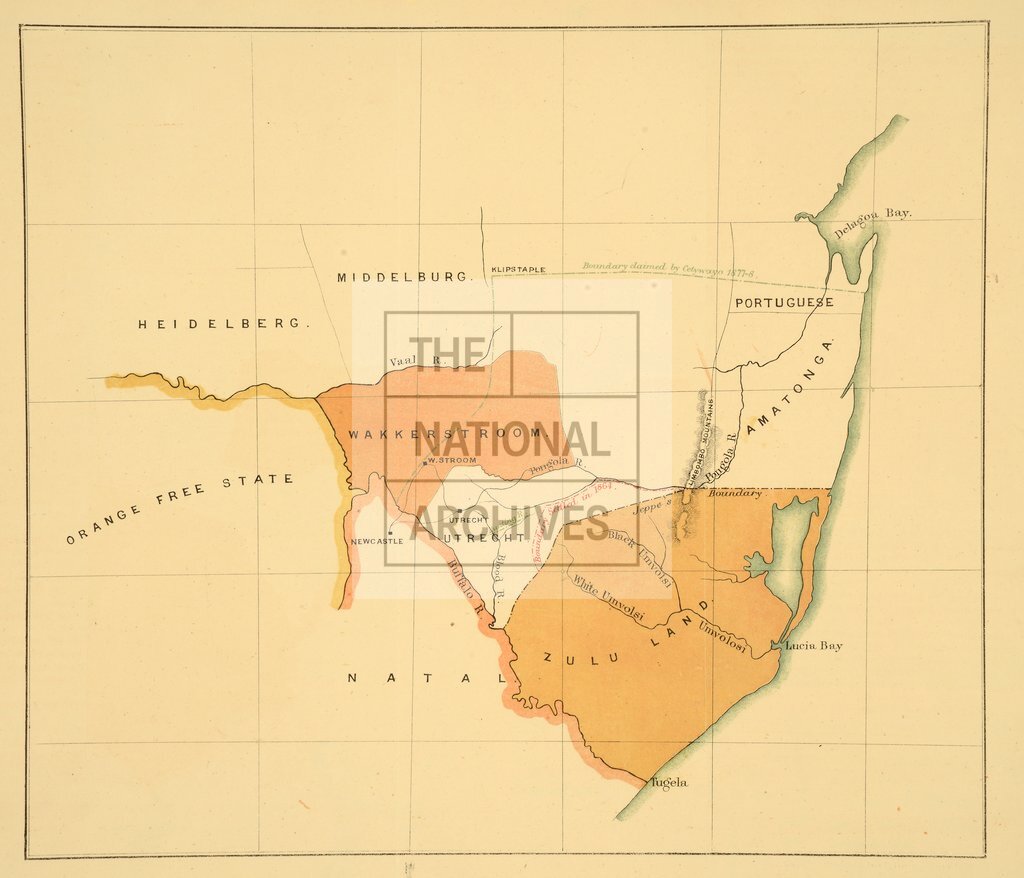
Zululand and surrounding territories
Date:
1878
Reference:
MPG 1/1120/1
Creator:
Maps and plans extracted to flat storage from records of the Colonial Office
Catalogue context:
1 item extracted from CO 879/13/1 . Southern Africa: Natal, Transvaal, Swaziland. Map of Zululand (now Kwazulu, in Kwazulu/Natal) and surrounding territories (Natal, now in Kwazulu/Natal, Transvaal and Swaziland. Map shows the boundary as settled in 1864, Jeppe's boundary and boundary claimed by Cetewayo 1877-8. The map illustrates a report on Cetewayo's claim for increase in territory.
Categories:
Maps and plans
Subjects:
Africa; Archives and libraries; International; Maps and plans
Topics:
International trade and affairs; Land and buildings
Period:
Victorians
Copyright information:
Copyright clearance for publication is not required, except in the case of documents in third-party copyright.
Usage terms:
https://www.nationalarchives.gov.uk/documents/information-management/use-of-tna-materials.pdf