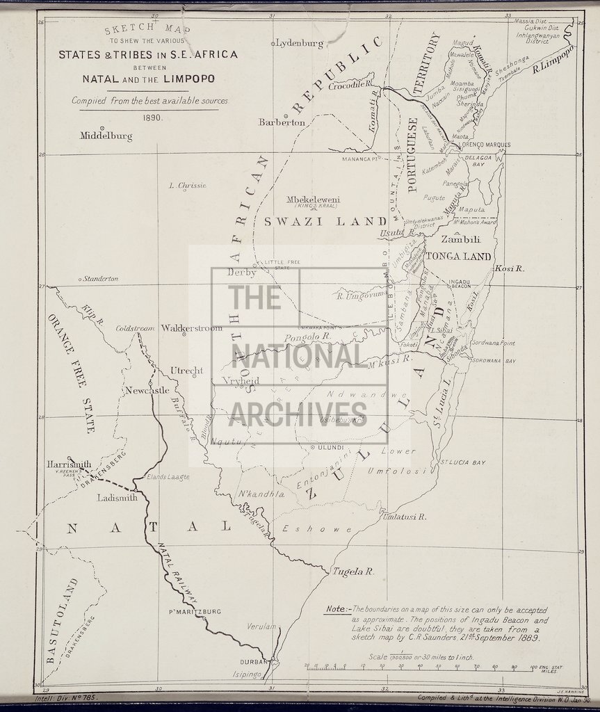
States and Tribes between Natal and the Limpopo River
Date:
1890
Reference:
MPGG 1/40/1
Creator:
Maps and plans extracted to extra large flat storage from records of the Colonial Office
Catalogue context:
'Sketch Map to shew the various States & Tribes in S.E. Africa between Natal and the Limpopo [River]. Compiled from the best available sources': (the area covered is now in Mozambique, Swaziland and Kwazulu/Natal province, South Africa). [By] J E Hawkins; compiled and lithographed at the Intelligence Division, War Office, January 1890.
Categories:
Maps and plans
Subjects:
Africa; Archives and libraries; Armed Forces (General Administration); Army; International; Maps and plans; Operations, battles and campaigns
Topics:
International trade and affairs; Land and buildings; Military and war
Period:
Victorians
Copyright information:
Copyright clearance for publication is not required, except in the case of documents in third-party copyright.
Usage terms:
https://www.nationalarchives.gov.uk/documents/information-management/use-of-tna-materials.pdf