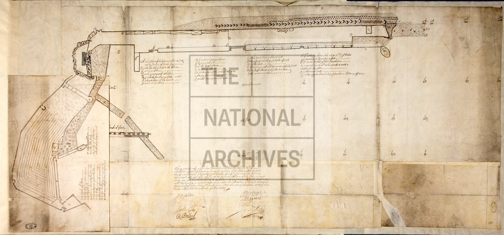
Detailed plan of the mole at Tangier
Date:
1673
Reference:
MPH 1/1 pt2 (14)
Creator:
Maps and plans extracted to flat storage from records of the War Office
Catalogue context:
54 maps and plans, all but one of which relate to Tangiers while it was a British possession. Detailed descriptions are given at item level. In 5 parts. ORDER THIS DOCUMENT AS MPH 1/1/1, MPH 1/1/12, MPH 1/1/23, MPH 1/1/34 and MPH 1/1/45
Categories:
Maps and plans
Subjects:
Archives and libraries; Armed Forces (General Administration); Army; Maps and plans
Topics:
Land and buildings; Military and war
Period:
Early Modern
Copyright information:
Copyright clearance for publication is not required, except in the case of documents in third-party copyright.
Usage terms:
https://www.nationalarchives.gov.uk/documents/information-management/use-of-tna-materials.pdf