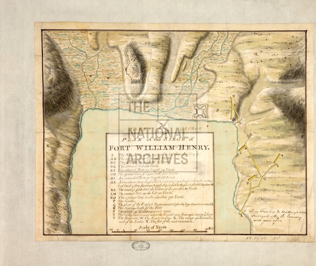
Siege of Fort William Henry
Date:
1757
Reference:
MPH 1/5/1
Creator:
Maps and plans extracted to flat storage from records of the War Office
Catalogue context:
'Plan of the Siege of Fort William Henry'. Scale: 1 inch to about 400 feet. Compass rose. Reference table to batteries, siege-works etc. Initialled by 'W.B.' [?William Brasier]. The remains of the fort are now in the town of Lake George, New York state, United States of America: the town was formerly called Caldwell.
Categories:
Maps and plans
Subjects:
Americas; Archives and libraries; Armed Forces (General Administration); Army; Maps and plans; Operations, battles and campaigns
Topics:
International trade and affairs; Land and buildings; Military and war
Period:
Empire And Industry
Copyright information:
Copyright clearance for publication is not required, except in the case of documents in third-party copyright.
Usage terms:
https://www.nationalarchives.gov.uk/documents/information-management/use-of-tna-materials.pdf