Plan of the Post at Saratoga, New York
Date:
1757
Reference:
MPH 1/5/6
Creator:
Maps and plans extracted to flat storage from records of the War Office
Catalogue context:
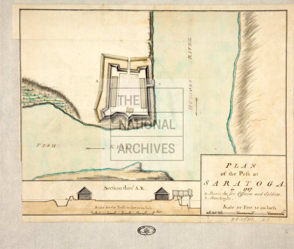
New York. 'Plan of the Post at Saratoga in 1757', with a section. Scale: plan 1 inch to 50 feet; section 1 inch to 20 feet. Reference table to barracks and storehouses. The fort at Old Saratoga, now in Schuylerville, is at the junction of the Fish Kill and Hudson Rivers, which are shown on the plan.
Categories:
Maps and plans; Overseas
Subjects:
Archives and libraries; Armed Forces (General Administration); Army; Maps and plans
Topics:
Land and buildings; Military and war
Period:
Empire And Industry
Places:
Americas
Copyright information:
Copyright clearance for publication is not required, except in the case of documents in third-party copyright.
Usage terms:
https://www.nationalarchives.gov.uk/documents/information-management/use-of-tna-materials.pdf