War of 1812 Position of the British and American Forces near New Orleans from
Date:
23 Dec 1814 to 8 Jan 1815
Reference:
MPH 1/73/1
Creator:
Maps and plans extracted to flat storage from records of the War Office
Catalogue context:
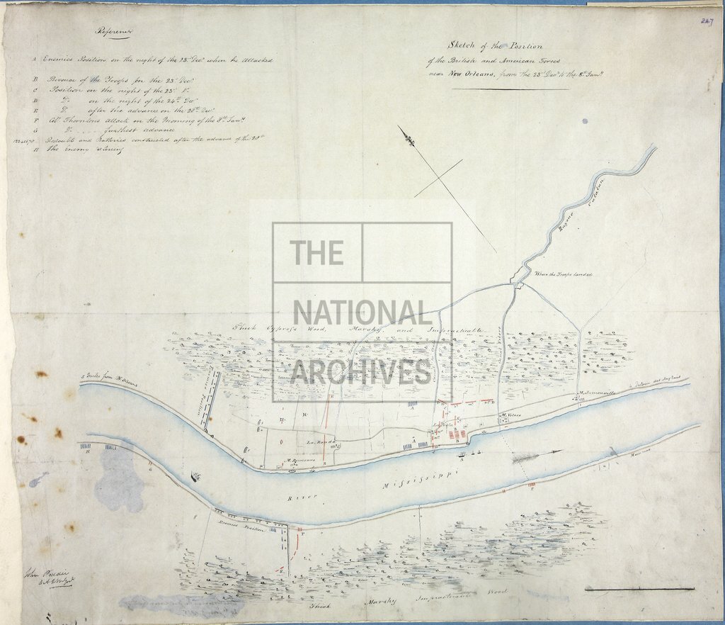
Louisiana. 'Sketch of the Position of the British and American Forces near New Orleans from the 23rd Decr [1814] to the 8th Jany [1815]'. No scale shown. Compass indicator. Reference table to British and American positions. Signed by John Pedder, DAQMG.
Categories:
Maps and plans
Subjects:
Americas; Archives and libraries; Armed Forces (General Administration); Army; Maps and plans; Operations, battles and campaigns
Topics:
International trade and affairs; Land and buildings; Military and war
Period:
Empire And Industry
Copyright information:
Copyright clearance for publication is not required, except in the case of documents in third-party copyright.
Usage terms:
https://www.nationalarchives.gov.uk/documents/information-management/use-of-tna-materials.pdf