The Downs, Kent
Date:
1736
Reference:
MPH 1/218
Creator:
Maps and plans extracted to flat storage from records of the War Office
Catalogue context:
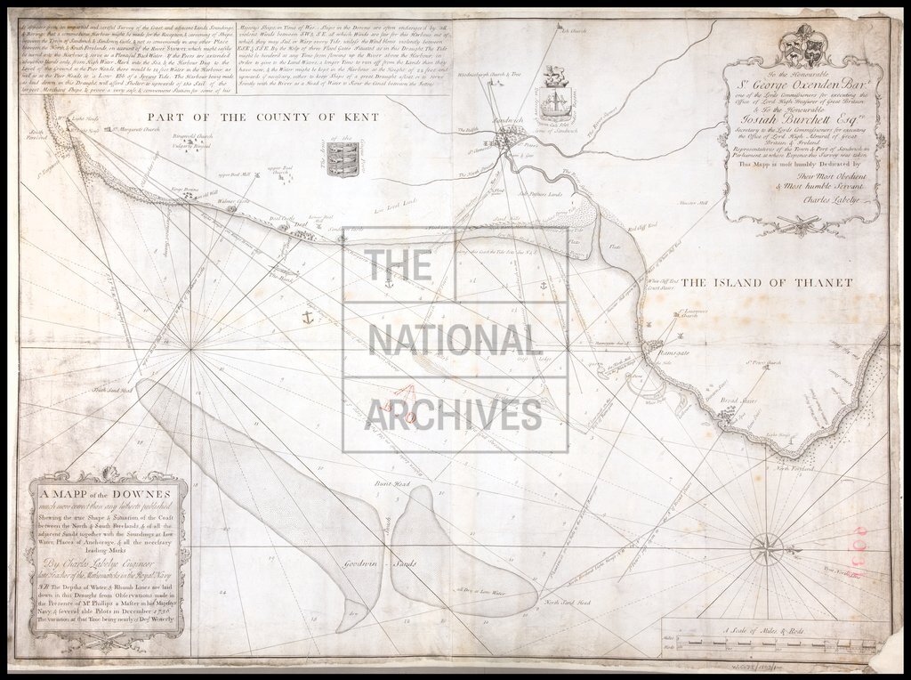
Kent: The Downs. 'A Mapp of the Downes much more correct than any hitherto published Shewing the true Shape & Situation of the Coast between the North and South Forelands and of all the adjacent Sands, together with the Soundings at Low Water, Places of Anchorage & all the necessary leading marks. By Charles Labelye, Engineer, late Teacher of the Mathematics in the Royal Navy.' Title and dedication in rococo cartouches. Scale: 2 inches to 1 mile. Compass star.
Categories:
Maps and plans
Subjects:
Archives and libraries; Armed Forces (General Administration); Army; Maps and plans; Navy
Topics:
Land and buildings; Military and war
Period:
Early Modern
Copyright information:
Copyright clearance for publication is not required, except in the case of documents in third-party copyright.
Usage terms:
https://www.nationalarchives.gov.uk/documents/information-management/use-of-tna-materials.pdf