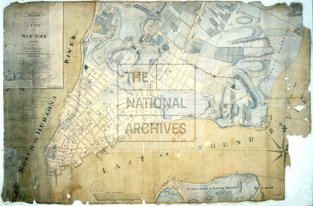
Map of Manhattan island, New York c1776
Date:
1776
Reference:
MPH 1/225
Creator:
Maps and plans extracted to flat storage from records of the War Office
Catalogue context:
'Plan of the City of New York Survey'd by Bern d . Ratzen, Lieut. in the 60 th Regt.'. The part of the town destroyed by the fire of 21 September 1776 is coloured red, now much faded. Streets named; some owners of houses on the outskirts. Reference tables to churches and other principal buildings; forts, batteries, entrenchments etc. Scale: 1 inch to about 400 feet. Compass star. Drawn by F Walden.
Categories:
Maps and plans; Overseas
Subjects:
Archives and libraries; Armed Forces (General Administration); Army; Maps and plans; Religions
Topics:
Land and buildings; Military and war; Religion
Period:
Empire And Industry
Places:
Americas
Copyright information:
Copyright clearance for publication is not required, except in the case of documents in third-party copyright.
Usage terms:
https://www.nationalarchives.gov.uk/documents/information-management/use-of-tna-materials.pdf