Chatham Dock, Rochester Bridge, Upnor Castle, Cockham Wood Fort, Gillingham, Strood
Date:
1756-1779
Reference:
MPH 1/358 (2)
Creator:
Maps and plans extracted to flat storage from records of the War Office
Catalogue context:
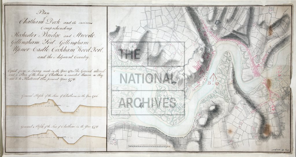
(1) Kent: 'Plan of Chatham Dock and its environs Comprehending Rochester Bridge and Stroode Gillingham, Fort Gillingham, Upnor Castle, Cockham Wood Fort, and the adjoining Country. Coppied from a Survey made in the Year 1724. The ground altered and a Plan of the Lines of Chatham is inserted thereon as they are to be restored this present Year 1779'. Title and sections through the Line in (i) 1756 and (ii) 1779 are to the left of the plan. Scale: 5.1 inches to 4,100 feet. Compass indicator: oriented to the south. Bears Board of ordnance stamp. (2) Duplicate of (1).
Categories:
Maps and plans
Subjects:
Archives and libraries; Armed Forces (General Administration); Army; Maps and plans
Topics:
Land and buildings; Military and war
Period:
Empire And Industry
Copyright information:
Copyright clearance for publication is not required, except in the case of documents in third-party copyright.
Usage terms:
https://www.nationalarchives.gov.uk/documents/information-management/use-of-tna-materials.pdf