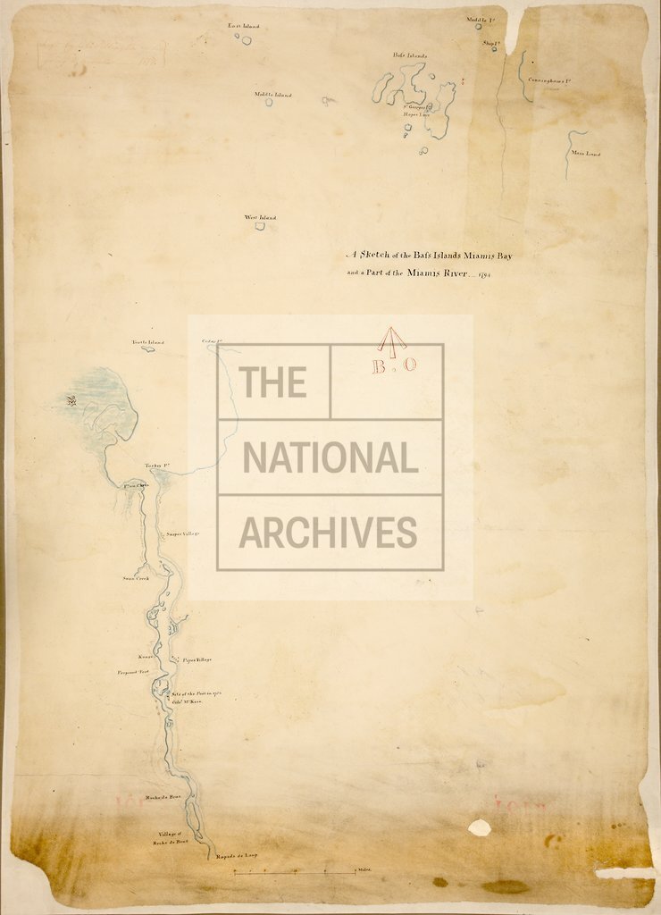
Bass Islands, Miamis Bay and a Part of the Miamis River, Ohio
Date:
1794
Reference:
MPH 1/466
Creator:
Maps and plans extracted to flat storage from records of the War Office
Catalogue context:
'A Sketch of the Bass Islands, Miamis Bay and a Part of the Miamis River 1794. Robt. Pilkington, Lieut. Royal Engineers': map of Maumee Bay (Lake Erie) and the Maumee River for about 25 miles inland (now in Ohio, United States of America), showing place names, forts, villages. Scale: 1 inch to 2 miles. Originally enclosed in Lord Dorchester's despatch of 7 June 1794. Endorsed: '... Left by Coll. Pilkington on going to Gibraltar 1818.'
Categories:
Maps and plans; Overseas
Subjects:
Americas; Archives and libraries; Armed Forces (General Administration); Army; Europe and Russia; Maps and plans; Operations, battles and campaigns
Topics:
International trade and affairs; Land and buildings; Military and war
Period:
Empire And Industry
Copyright information:
Copyright clearance for publication is not required, except in the case of documents in third-party copyright.
Usage terms:
https://www.nationalarchives.gov.uk/documents/information-management/use-of-tna-materials.pdf