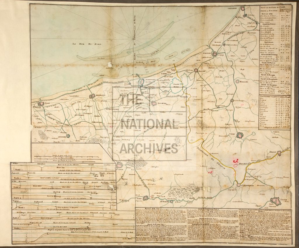
Coast from Calais to Ostend, with canals and canal sections c1750s
Date:
1730-1770
Reference:
MPH 1/626
Creator:
Maps and plans extracted to flat storage from records of the War Office
Catalogue context:
Map of area between Calais, Ostend, Lille, Ypres and Menin (now partly in France and partly in Belgium), showing rivers and canals. With seven sections of canals. Notes on sections; table of locks, with measurements. Scale: 18.2 cm to 5 French leagues. Compass indicator.
Categories:
Maps and plans
Subjects:
Archives and libraries; Armed Forces (General Administration); Army; Canals and river transport; Europe and Russia; Maps and plans
Topics:
International trade and affairs; Land and buildings; Military and war; Transport and travel
Period:
Early Modern
Copyright information:
Copyright clearance for publication is not required, except in the case of documents in third-party copyright.
Usage terms:
https://www.nationalarchives.gov.uk/documents/information-management/use-of-tna-materials.pdf