Lighthouse on Anholt Island
Date:
1811
Reference:
MPHH 1/194 (4)
Creator:
Maps and plans extracted to extra large flat storage from records of the War Office
Catalogue context:
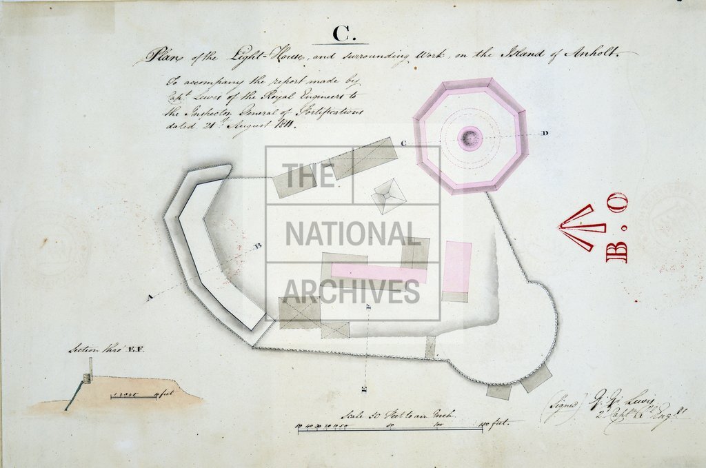
Denmark. (1) 'Section of the Light-House and surrounding Work on the Island of Anholt'. (2) Copy of (1). (3) 'Plan of the Light-House and surrounding Work on the Island of Anholt'. (4) Copy of (3). (5) 'The Island of Anholt': bird's eye view, looking south, showing positions of lighthouse, reef and village. (6) Copy of (5) orientated northwards. Scales: (1) and (2) 1 inch to 20 feet [1:240]; (3) and (4) 1 inch to 50 feet [1:600]; (5) and (6) 1 inch to 200 yards [1:7,200]. All signed by Captain G G Lewis, RE; to accompany his report to the Inspector General of Fortifications, 21 August 1811. Dimensions: (1) to (4) 47 cm x 24 cm; (5) and (6) 122 cm x 46 cm.
Categories:
Maps and plans
Subjects:
Archives and libraries; Armed Forces (General Administration); Army; Europe and Russia; Maps and plans
Topics:
International trade and affairs; Land and buildings; Military and war
Period:
Empire And Industry
Copyright information:
Copyright clearance for publication is not required, except in the case of documents in third-party copyright.
Usage terms:
https://www.nationalarchives.gov.uk/documents/information-management/use-of-tna-materials.pdf