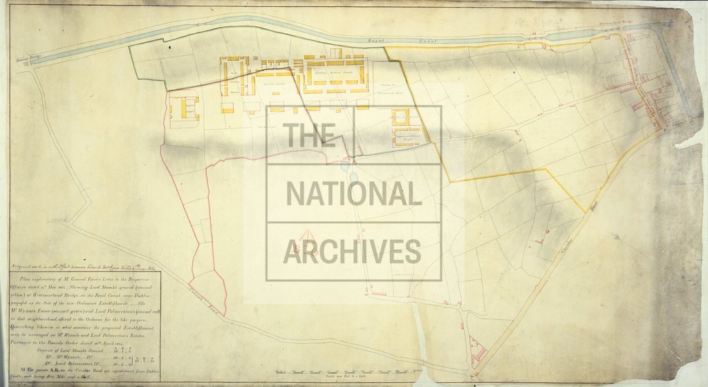
Westmorland Bridge on Royal Canal near Dublin showing proposed new Ordnance Establishment
Date:
1814-1815
Reference:
MPHH 1/230 (3)
Creator:
Maps and plans extracted to extra large flat storage from records of the War Office
Catalogue context:
Ireland: City of Dublin. Plans of Westmorland Bridge on Royal Canal near Dublin: different plan versions showing the site of the proposed new Ordnance Establishment: (1) Plan showing land ordered to be purchased as per Major General Fyers's letter, 1 February 1815. Copied by M W Lewis, Cadet, February 1815. Compass indicator. (2) Plan showing arrangement submitted to Lieutenant General Mann, 10 May 1815. (3) Copy of the explanatory plan accompanying Major General Fyers's letter, 14 May 1814. Scales: (1) 1 inch to 20 perches [1:3,960 (English perch)]; (2)-(3) 1 inch to 200 feet [1:2400]. Compass indicators. Dimensions: (1) 31.2 cm x 49.5 cm; (2) 57.1 cm x 83.1 cm; (3) 57.9 cm x 104.1 cm.
Categories:
Maps and plans; Overseas
Subjects:
Archives and libraries; Armed Forces (General Administration); Army; Canals and river transport; Ireland; Maps and plans
Topics:
International trade and affairs; Land and buildings; Military and war; Transport and travel
Period:
Empire And Industry
Places:
Ireland
Copyright information:
Copyright clearance for publication is not required, except in the case of documents in third-party copyright.
Usage terms:
https://www.nationalarchives.gov.uk/documents/information-management/use-of-tna-materials.pdf