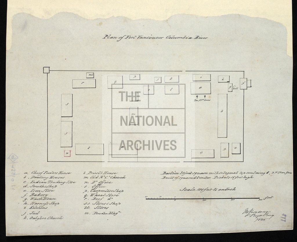
Fort Vancouver, Washington State, plan
Date:
1845
Reference:
MPHH 1/459 (6)
Creator:
Maps and plans extracted to extra large flat storage from records of the War Office
Catalogue context:
8 items extracted from WO 1/552 . Maps and plans of Ontario and British Columbia (now in Canada); and Washington State (now in United States of America). Detailed descriptions are given at item level.
Categories:
Maps and plans; Overseas
Subjects:
Americas; Archives and libraries; Armed Forces (General Administration); Army; Maps and plans; Operations, battles and campaigns
Topics:
International trade and affairs; Land and buildings; Military and war
Period:
Empire And Industry
Places:
Canada
Copyright information:
Copyright clearance for publication is not required, except in the case of documents in third-party copyright.
Usage terms:
https://www.nationalarchives.gov.uk/documents/information-management/use-of-tna-materials.pdf