USA, Mexico, West Indies
Date:
1671
Reference:
MPI 1/11
Creator:
Maps and plans extracted to flat storage from records of departments not assigned an individual map extract prefix
Catalogue context:
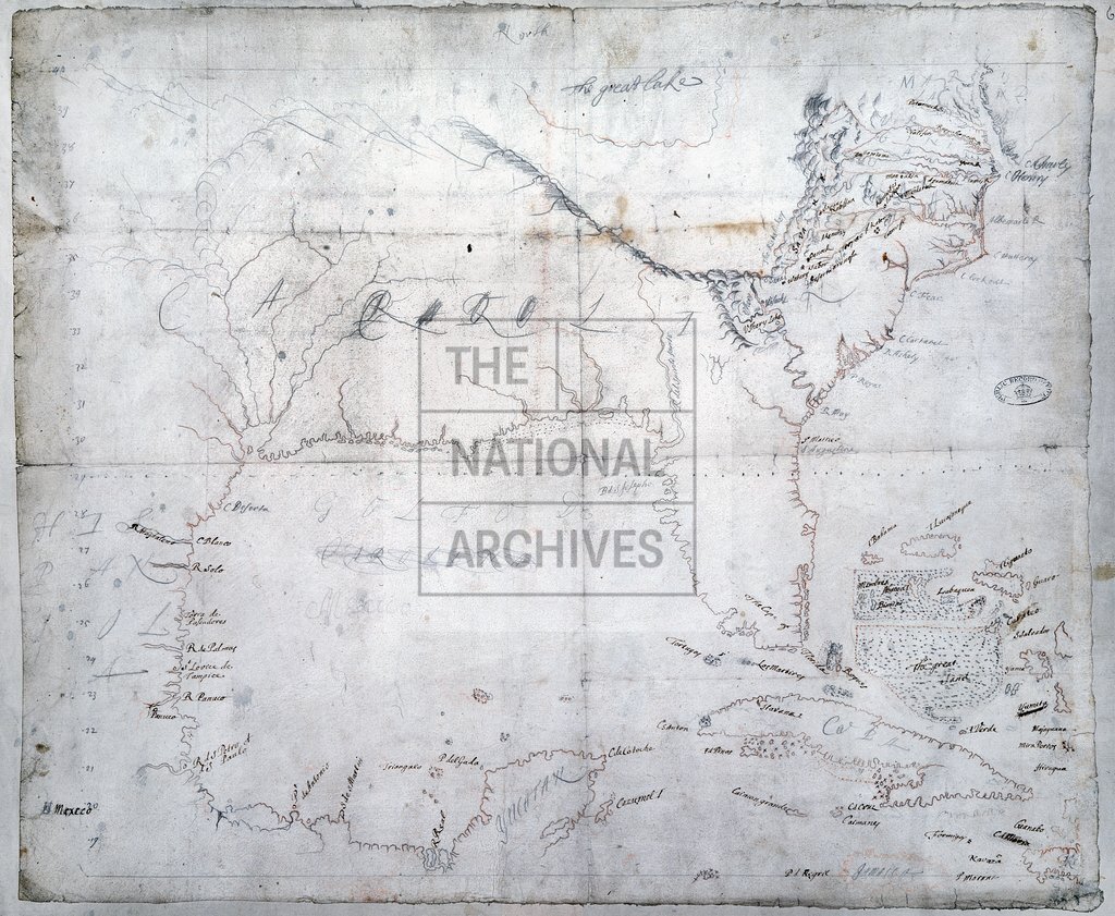
1 item extracted from PRO 30/24/48 . Map of the south eastern part of North America and part of South America from Yucatan to Chesapeake Bay, showing place names, shoals, rocks, mountains, degrees of latitude, and 'the great lake' (Lake Erie). Jamaica, Cuba and the Bahamas are also shown. A dotted line across the map at about 29°N shows the southern limit of what was to become Carolina. Scale: 1 inch to 96 miles. An MS note on the dorse reads 'Map of Carolina 71' ascribed to John Locke.
Categories:
Maps and plans
Subjects:
Americas; Archives and libraries; Caribbean; Maps and plans
Topics:
International trade and affairs; Land and buildings
Period:
Early Modern
Copyright information:
Copyright clearance for publication is not required, except in the case of documents in third-party copyright.
Usage terms:
https://www.nationalarchives.gov.uk/documents/information-management/use-of-tna-materials.pdf