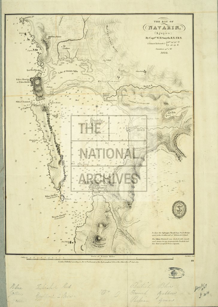
Navarino Bay, Pylos, Greece, showing the town and castle
Date:
1830
Reference:
MPI 1/44
Creator:
Maps and plans extracted to flat storage from records of departments not assigned an individual map extract prefix
Catalogue context:
1 item (accompanying papers relating to Navarino) extracted from ADM 1/467 . Greece: Pylos. Admiralty chart of Navarino Bay, showing the town and castle, soundings, the island of Sphagia, rivers, hachures and roads. Surveyed by Captain W H Smyth, RN FRS. Compass rose. Engraved by J & C Walker. Published at the Hydrographic Office, Admiralty, 20 September 1830.
Categories:
Maps and plans
Subjects:
Archives and libraries; Armed Forces (General Administration); Europe and Russia; Maps and plans; Navy
Topics:
International trade and affairs; Land and buildings; Military and war
Period:
Empire And Industry
Copyright information:
Copyright clearance for publication is not required, except in the case of documents in third-party copyright.
Usage terms:
https://www.nationalarchives.gov.uk/documents/information-management/use-of-tna-materials.pdf