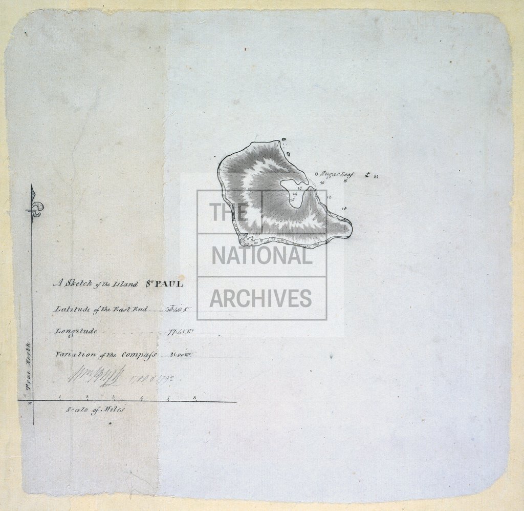
St Paul's Island, by Captain William Bligh
Date:
1788-1792
Reference:
MPI 1/69
Creator:
Maps and plans extracted to flat storage from records of departments not assigned an individual map extract prefix
Catalogue context:
1 item (illustrating the log of HMS Providence, 1791-1792) extracted from ADM 55/152 . Indian Ocean: St Paul Island (Île Saint-Paul). Sketch map. Scale: 1 inch to 2 miles. Compass indicator. Signed by William Bligh, 1788 and 1792.
Categories:
Maps and plans
Subjects:
Archives and libraries; Maps and plans; Navy
Topics:
Land and buildings; Military and war
Period:
Empire And Industry
Copyright information:
Copyright clearance for publication is not required, except in the case of documents in third-party copyright.
Usage terms:
https://www.nationalarchives.gov.uk/documents/information-management/use-of-tna-materials.pdf