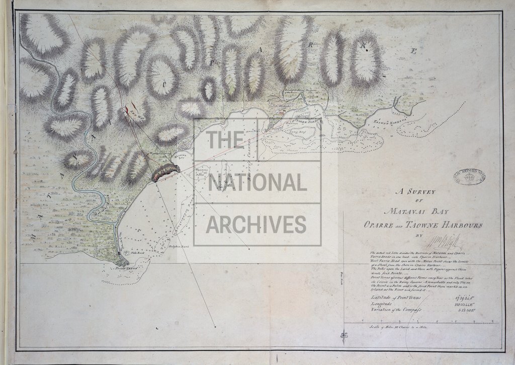
Matavai Bay, Tahiti, drawn by Captain William Bligh
Date:
1792
Reference:
MPI 1/72
Creator:
Maps and plans extracted to flat storage from records of departments not assigned an individual map extract prefix
Catalogue context:
1 item (illustrating the log of HMS Providence, 1791-1792) extracted from ADM 55/152 . Society Islands: Tahiti. Map of Matavai Bay, 'Oparre' and 'Taowne harbour'. Scale: 1 inch to 30 chains. Drawn by William Bligh. ORDER THIS DOCUMENT AS MPI 1/69 .
Categories:
Maps and plans
Subjects:
Archives and libraries; Australia and Pacific; Maps and plans; Navy
Topics:
International trade and affairs; Land and buildings; Military and war
Period:
Empire And Industry
Copyright information:
Copyright clearance for publication is not required, except in the case of documents in third-party copyright.
Usage terms:
https://www.nationalarchives.gov.uk/documents/information-management/use-of-tna-materials.pdf