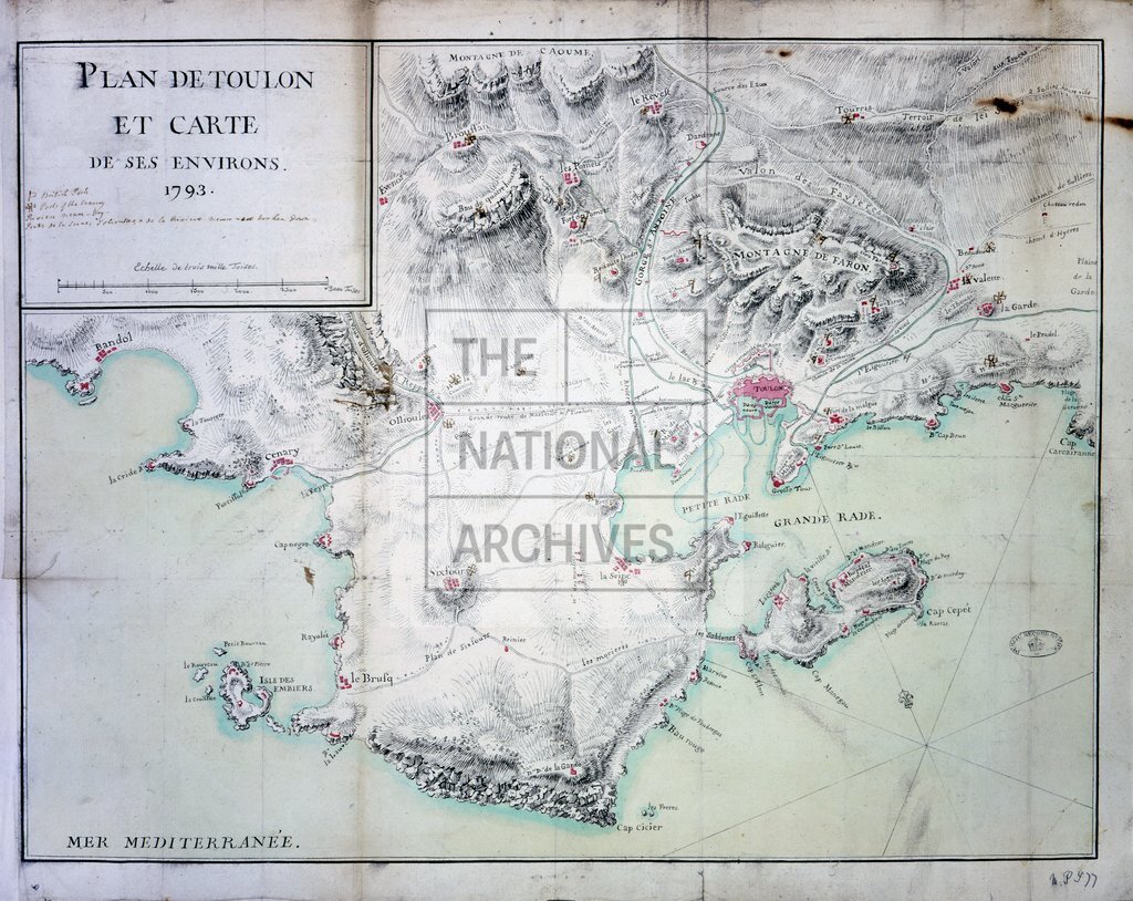
Plan of Toulon and environs, showing British and French posts, 1793 (250MB)
Date:
1793
Reference:
MPI 1/77
Creator:
Maps and plans extracted to flat storage from records of departments not assigned an individual map extract prefix
Catalogue context:
1 item (enclosure to Lord Mulgrave's no 6 of 26 Sept 1793) extracted from HO 50/455 . France. 'Plan de Toulon et Carte de ses Environs. 1793'. Reference table to British and French posts. Scale: 14.8 cm to 3,000 toises . Compass indicator.
Categories:
Maps and plans; Overseas
Subjects:
Archives and libraries; Europe and Russia; Maps and plans
Topics:
International trade and affairs; Land and buildings
Period:
Empire And Industry
Places:
France
Copyright information:
Copyright clearance for publication is not required, except in the case of documents in third-party copyright.
Usage terms:
https://www.nationalarchives.gov.uk/documents/information-management/use-of-tna-materials.pdf