Part of the North West coast of America explored by Captain James Cook
Date:
1778
Reference:
MPI 1/83
Creator:
Maps and plans extracted to flat storage from records of departments not assigned an individual map extract prefix
Catalogue context:
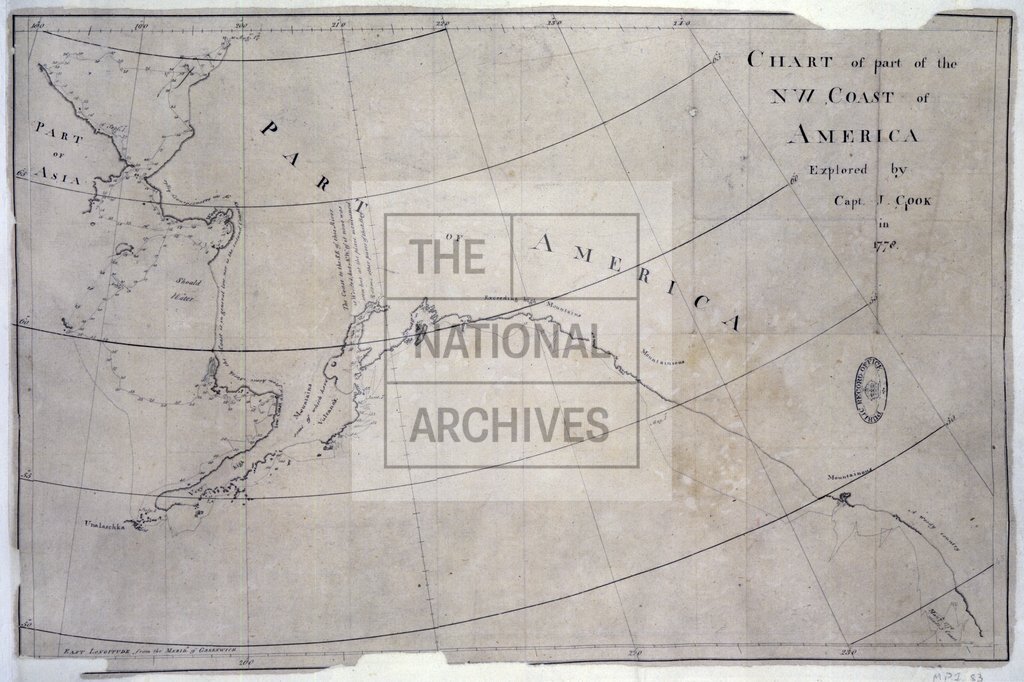
1 item (enclosed in a letter dated 20 October 1778 from Captain James Cook to the Secretary of the Admiralty) extracted from ADM 1/1612 . North America. Chart of part of the north west coast as explored by Captain Cook in 1778, showing the ship's track from about 44°N to the shores of the Bering Sea, with soundings, dates and notes on the coastline. Longitude is measured east from Greenwich. Scale: 1 inch to 140 miles.
Categories:
Maps and plans
Subjects:
Americas; Archives and libraries; Armed Forces (General Administration); Maps and plans; Navy
Topics:
International trade and affairs; Land and buildings; Military and war
Period:
Empire And Industry
Copyright information:
Copyright clearance for publication is not required, except in the case of documents in third-party copyright.
Usage terms:
https://www.nationalarchives.gov.uk/documents/information-management/use-of-tna-materials.pdf