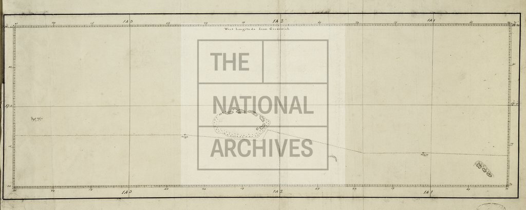
Cook's chart of Tuamotu, French Polynesia, showing the track of HMS Resolution 172-
Date:
1775
Reference:
MPI 1/86
Creator:
Maps and plans extracted to flat storage from records of departments not assigned an individual map extract prefix
Catalogue context:
1 item (illustrating the log of HMS Resolution, Captain James Cook, 1772-1775) extracted from ADM 55/108 . Pacific Ocean. Chart showing the an unnamed atoll [probably 'Doubtful Island' (now Tekokota, Tuamotu, French Polynesia)] and part of the course of HMS Resolution. Scale not shown. ORDER THIS DOCUMENT AS MPI 1/85 .
Categories:
Maps and plans; Overseas
Subjects:
Archives and libraries; Australia and Pacific; Maps and plans; Navy
Topics:
International trade and affairs; Land and buildings; Military and war; Transport and travel
Period:
Empire And Industry
Places:
France
Copyright information:
Copyright clearance for publication is not required, except in the case of documents in third-party copyright.
Usage terms:
https://www.nationalarchives.gov.uk/documents/information-management/use-of-tna-materials.pdf