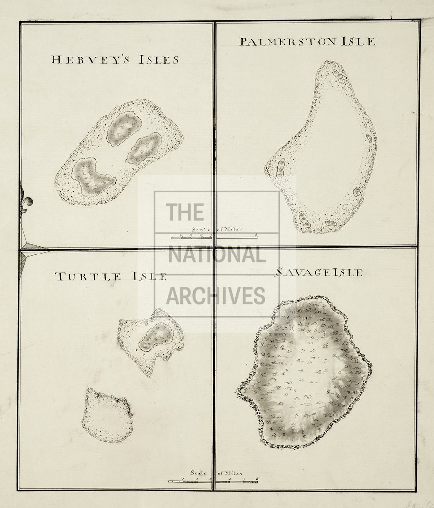
Cook's chart of Palmerston Island, Turtle Island and Savage Island
Date:
1772-1775
Reference:
MPI 1/88
Creator:
Maps and plans extracted to flat storage from records of departments not assigned an individual map extract prefix
Catalogue context:
1 item (illustrating the log of HMS Resolution, Captain James Cook, 1772-1775) extracted from ADM 55/108 . Pacific Ocean. 4 outline maps on 1 sheet, showing Hervey Island (Manuae, now in the Cook Islands), Palmerston Island (now in the Cook Islands), Turtle Island (Vatoa, Fiji) and Savage Island (Niue). Scale: 1 inch to 3 miles. ORDER THIS DOCUMENT AS MPI 1/85 .
Categories:
Maps and plans
Subjects:
Archives and libraries; Australia and Pacific; Maps and plans; Navy
Topics:
International trade and affairs; Land and buildings; Military and war
Period:
Empire And Industry
Copyright information:
Copyright clearance for publication is not required, except in the case of documents in third-party copyright.
Usage terms:
https://www.nationalarchives.gov.uk/documents/information-management/use-of-tna-materials.pdf