Cook's chart of the course of HMS Resolution round Cape Horn
Date:
1773
Reference:
MPI 1/91
Creator:
Maps and plans extracted to flat storage from records of departments not assigned an individual map extract prefix
Catalogue context:
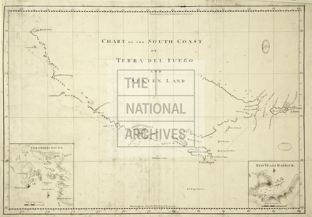
1 item (illustrating the log of HMS Resolution, Captain James Cook, 1772-1775) extracted from ADM 55/108 . Argentina. Chart of the south coast of Tierra del Fuego and Staten Island (now Isla de los Estados), showing the course of HMS Resolution round Cape Horn in 1773; also showing soundings. Scale: 1 inch to 16 miles. Insets: (i) Christmas Sound, scale: 1 inch to 4 miles; (ii) New Year's Harbour, scale: 1 inch to 1 mile. Compass indicators to both insets. ORDER THIS DOCUMENT AS MPI 1/85 .
Categories:
Maps and plans
Subjects:
Americas; Archives and libraries; Maps and plans; Navy
Topics:
International trade and affairs; Land and buildings; Military and war; Transport and travel
Period:
Empire And Industry
Copyright information:
Copyright clearance for publication is not required, except in the case of documents in third-party copyright.
Usage terms:
https://www.nationalarchives.gov.uk/documents/information-management/use-of-tna-materials.pdf