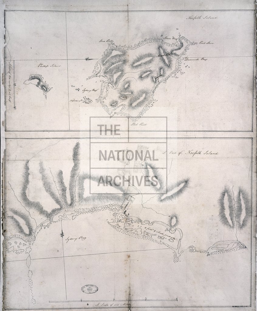
Norfolk Island ansd Norfolk Island South, from Cook's Journal
Date:
1785-1789
Reference:
MPI 1/116 (1)
Creator:
Maps and plans extracted to flat storage from records of departments not assigned an individual map extract prefix
Catalogue context:
2 items extracted from ADM 1/2308 . Pacific Ocean. (1) 2 maps on a single sheet: (i) Norfolk Island; (ii) Sydney Bay, Norfolk Island. Scales: (i) 1 inch to 2 miles and (ii) 1 inch to one eighth of a mile. (2) 2 items on a single sheet. Solomon Islands: (i) view of the west side of Lord Howe Island; (ii) map of Lord Howe Island. Scale: (ii) 1 inch to two thirds of a mile. Compass indicators on (1) and (2) (ii). Dimensions of sheets: (1) 57.5 cm x 44.5 cm; (2) 31 cm x 79.5 cm.
Categories:
Maps and plans
Subjects:
Archives and libraries; Australia and Pacific; Maps and plans
Topics:
International trade and affairs; Land and buildings
Period:
Empire And Industry
Copyright information:
Copyright clearance for publication is not required, except in the case of documents in third-party copyright.
Usage terms:
https://www.nationalarchives.gov.uk/documents/information-management/use-of-tna-materials.pdf