Island of Martinique
Date:
1757
Reference:
MPI 1/118
Creator:
Maps and plans extracted to flat storage from records of departments not assigned an individual map extract prefix
Catalogue context:
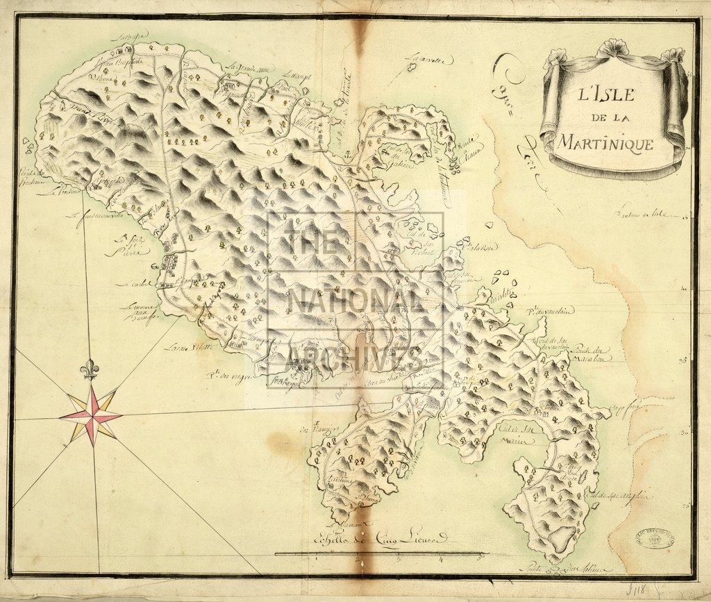
1 item extracted from HCA 32/176 (formerly HCA 30/707). 'L'Isle de la Martinique': map showing terrain, settlements and roads. Title in decorative cartouche. Scale: 2.5 cm to 1 lieue . Compass rose. The map was probably captured with other papers from the French ship Le Constant during the Seven Years War.
Categories:
Maps and plans
Subjects:
Archives and libraries; Caribbean; Maps and plans; Operations, battles and campaigns
Topics:
International trade and affairs; Land and buildings; Military and war
Period:
Empire And Industry
Copyright information:
Copyright clearance for publication is not required, except in the case of documents in third-party copyright.
Usage terms:
https://www.nationalarchives.gov.uk/documents/information-management/use-of-tna-materials.pdf