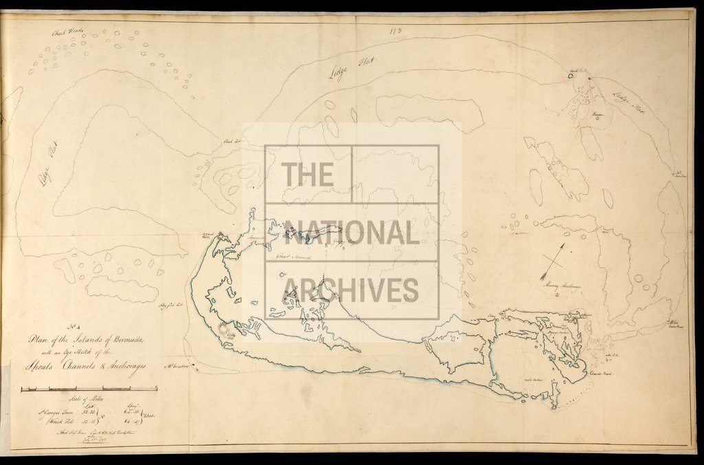
Bermuda, with sketch of shoals, channels and anchorages
Date:
1795
Reference:
MPI 1/160/4
Creator:
Maps and plans extracted to flat storage from records of departments not assigned an individual map extract prefix
Catalogue context:
Bermuda. Plan of the islands, with an 'Eye Sketch' of shoals, channels and anchorages. Scale: 1 inch to 1 mile. Compass indicator.
Categories:
Maps and plans; Overseas
Subjects:
Americas; Archives and libraries; Maps and plans; Navy
Topics:
International trade and affairs; Land and buildings; Military and war
Period:
Empire And Industry
Places:
Caribbean
Copyright information:
Copyright clearance for publication is not required, except in the case of documents in third-party copyright.
Usage terms:
https://www.nationalarchives.gov.uk/documents/information-management/use-of-tna-materials.pdf