Bedford Level Cambridgeshire
Date:
1543
Reference:
MPI 1/251
Creator:
Maps and plans extracted to flat storage from records of departments not assigned an individual map extract prefix
Catalogue context:
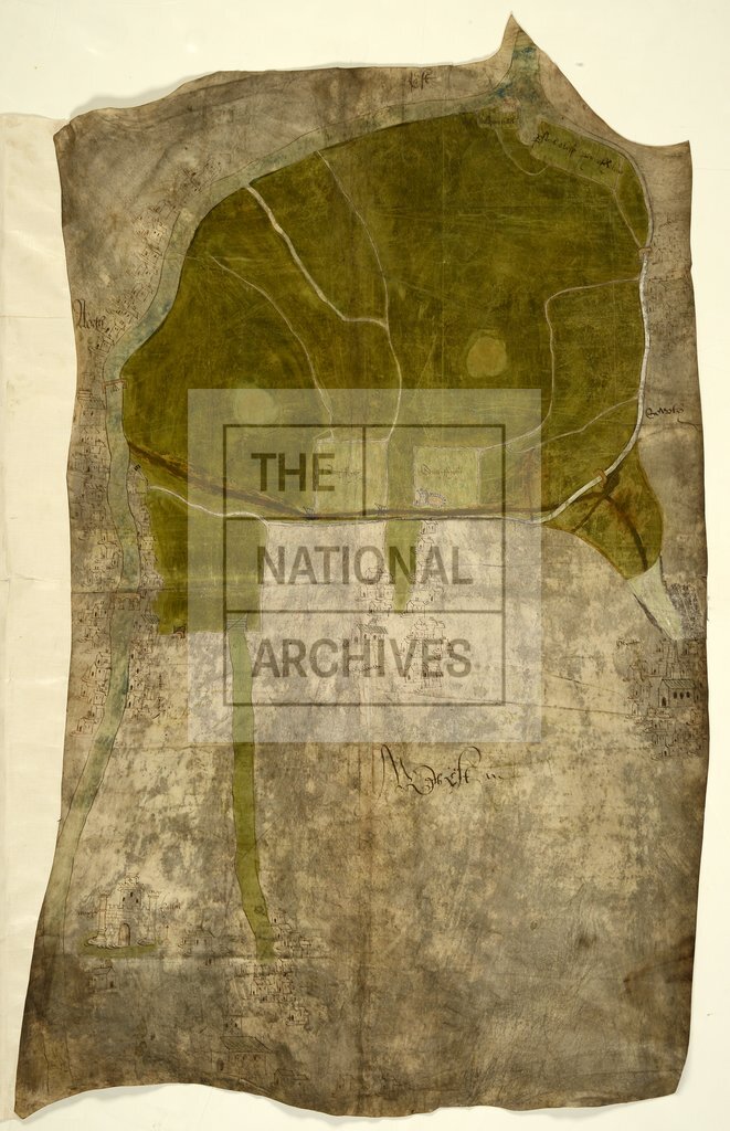
Cambridgeshire: Bedford Level. Plan of area of fen between Deeping Gate, Waldram Hall, Glinton and Maxey. Shows towns of Maxey, Deeping Gate, Deeping St James, Northborough, Glinton, Peakirk. Also shows River Welland and tributary; roads; fields of Parsons Close, Peynes Holme, South Fryth and North Fryth. Maxey castle, churches, bridges, gates, crosses, drawn in elevation; houses drawn conventionally. No scale shown. Cardinal points: oriented to the east. Endorsed: 'Inter maxey & Glynton' in contemporary hand. Drawn to illustrate a dispute over common of pasture in North Fen between the king's tenants of Maxey and the inhabitants of Glinton. Drawn between 24 November, 34 Henry VIII, when commissioners were instructed to make a map, and 9 June, 35 Henry VIII, when depositions were taken which mention view of the map (see E 315/120/158-159). For other proceedings in the case see E 321/4/18 and E 315/117/59-66.
Categories:
Maps and plans
Subjects:
Archives and libraries; Litigation; Maps and plans; Religions
Topics:
Crime, courts and justice; Land and buildings; Religion
Period:
Early Modern
Copyright information:
Copyright clearance for publication is not required, except in the case of documents in third-party copyright.
Usage terms:
https://www.nationalarchives.gov.uk/documents/information-management/use-of-tna-materials.pdf