North Eastern Ireland, by religions, as on 1911 Census 1925
Date:
1911-1925
Reference:
MPI 1/402/2
Creator:
Maps and plans extracted to flat storage from records of departments not assigned an individual map extract prefix
Catalogue context:
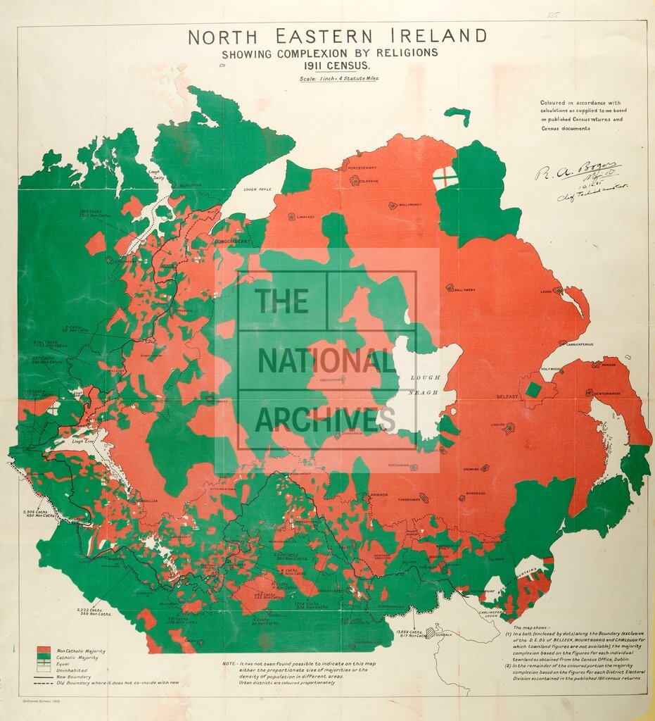
'North Eastern Ireland showing complexion by religions 1911 census.' Map, coloured pink for Protestant majority areas, green for Catholics and boundaries. Signed by Major R A Boger. Scale: 1 inch to 4 miles.
Categories:
Maps and plans; Overseas
Subjects:
Archives and libraries; Census; Ireland; Maps and plans; Religions
Topics:
British state and citizens; Family and identity; International trade and affairs; Land and buildings; Religion
Period:
Early 20th Century
Places:
Ireland
Copyright information:
Copyright clearance for publication is not required, except in the case of documents in third-party copyright.
Usage terms:
https://www.nationalarchives.gov.uk/documents/information-management/use-of-tna-materials.pdf