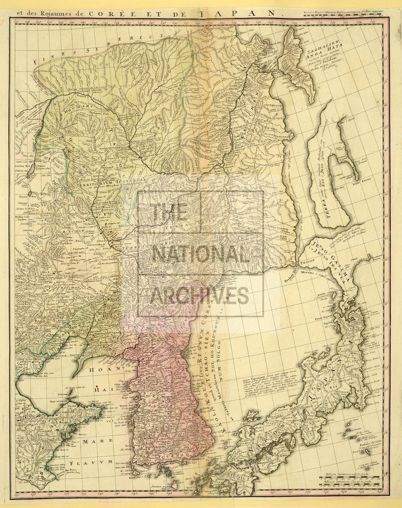
Map of eastern China, Korea, Japan and eastern Siberia 1600-1700.
Date:
1600-1700
Reference:
MPI 1/409 (4)
Creator:
Maps and plans extracted to flat storage from records of departments not assigned an individual map extract prefix
Catalogue context:
6 items: maps of East Asia and Europe, with a newspaper cutting. Detailed descriptions are given at item level.
Categories:
Maps and plans; Overseas
Subjects:
Archives and libraries; Asia; Europe and Russia; Maps and plans
Topics:
International trade and affairs; Land and buildings
Period:
Early Modern
Places:
China
Copyright information:
Copyright clearance for publication is not required, except in the case of documents in third-party copyright.
Usage terms:
https://www.nationalarchives.gov.uk/documents/information-management/use-of-tna-materials.pdf