Delhi and environs, India
Date:
1830-1870
Reference:
MPI 1/443/1
Creator:
Maps and plans extracted to flat storage from records of departments not assigned an individual map extract prefix
Catalogue context:
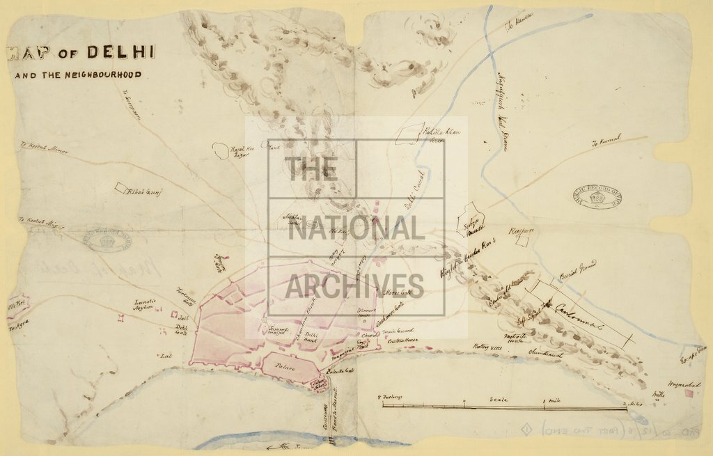
India. Map of Delhi and its environs showing the walled town, important buildings, the river and causeway, high ground, canals, roads and other buildings and sites outside the walls. Scale: 1 inch to 1 mile.
Categories:
Maps and plans; Overseas
Subjects:
Archives and libraries; Canals and river transport; Indian Subcontinent; Maps and plans
Topics:
International trade and affairs; Land and buildings; Transport and travel
Period:
Empire And Industry
Places:
India
Copyright information:
Copyright clearance for publication is not required, except in the case of documents in third-party copyright.
Usage terms:
https://www.nationalarchives.gov.uk/documents/information-management/use-of-tna-materials.pdf