Tabulated map of the towns of England and Wales
Date:
1680
Reference:
MPI 1/463
Creator:
Maps and plans extracted to flat storage from records of departments not assigned an individual map extract prefix
Catalogue context:
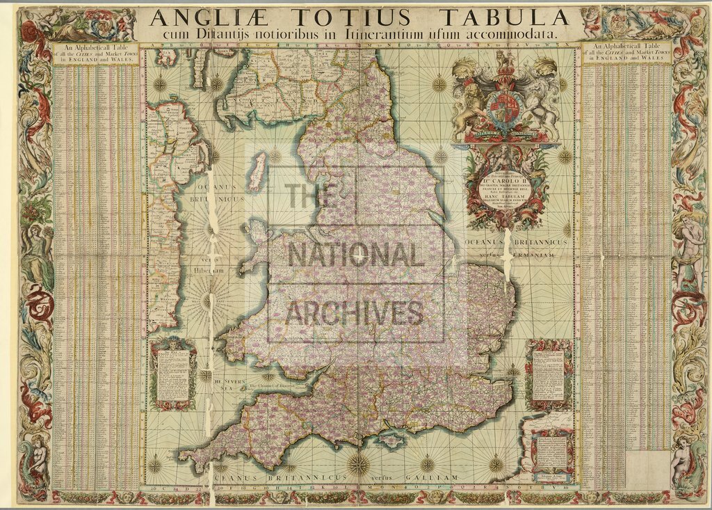
1 item, extracted from a copy of J Adams, Index Villaris (London, 1680), formerly held in the Round Room at the Public Record Office, Chancery Lane, and now in the National Archives Library. England and Wales. 'Angliae totius tabula cum distantiis notioribus in itinerantium usum accomodata': map showing counties, cities, market towns, roads, post roads and distances. Hills and rivers are also shown. Reference tables. Scale: 1 inch to 17 miles. Compass roses. Drawn by John Adams, Inner Temple. Printed by A Godbid and J Playford, 29 November 1680.
Categories:
Maps and plans
Subjects:
Archives and libraries; Maps and plans; Trade and commerce
Topics:
International trade and affairs; Land and buildings
Period:
Early Modern
Places:
England; Great Britain; Wales
Copyright information:
Copyright clearance for publication is not required, except in the case of documents in third-party copyright.
Usage terms:
https://www.nationalarchives.gov.uk/documents/information-management/use-of-tna-materials.pdf