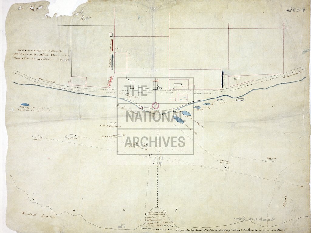
St Lawrence River between Prescott and Cornwall, showing positions of British ships
Date:
13-16 November 1838
Reference:
MPI 1/479
Creator:
Maps and plans extracted to flat storage from records of departments not assigned an individual map extract prefix
Catalogue context:
1 item extracted from PRO 30/9/6/13 . Upper Canada or Canada West (now Ontario). Map of part of the St Lawrence River between Prescott and Cornwall, showing positions of British ships 13 and 16 November [1838] and the position of troops on the bank. Scale: 1 inch to 240 yards. Originally accompanying a letter dated 13 February 1846.
Categories:
Maps and plans
Subjects:
Americas; Archives and libraries; Maps and plans
Topics:
International trade and affairs; Land and buildings
Period:
Empire And Industry
Copyright information:
Copyright clearance for publication is not required, except in the case of documents in third-party copyright.
Usage terms:
https://www.nationalarchives.gov.uk/documents/information-management/use-of-tna-materials.pdf