Belgrade fortress
Date:
1863
Reference:
MPK 1/40
Creator:
Maps and plans extracted to flat storage from records of the Foreign Office
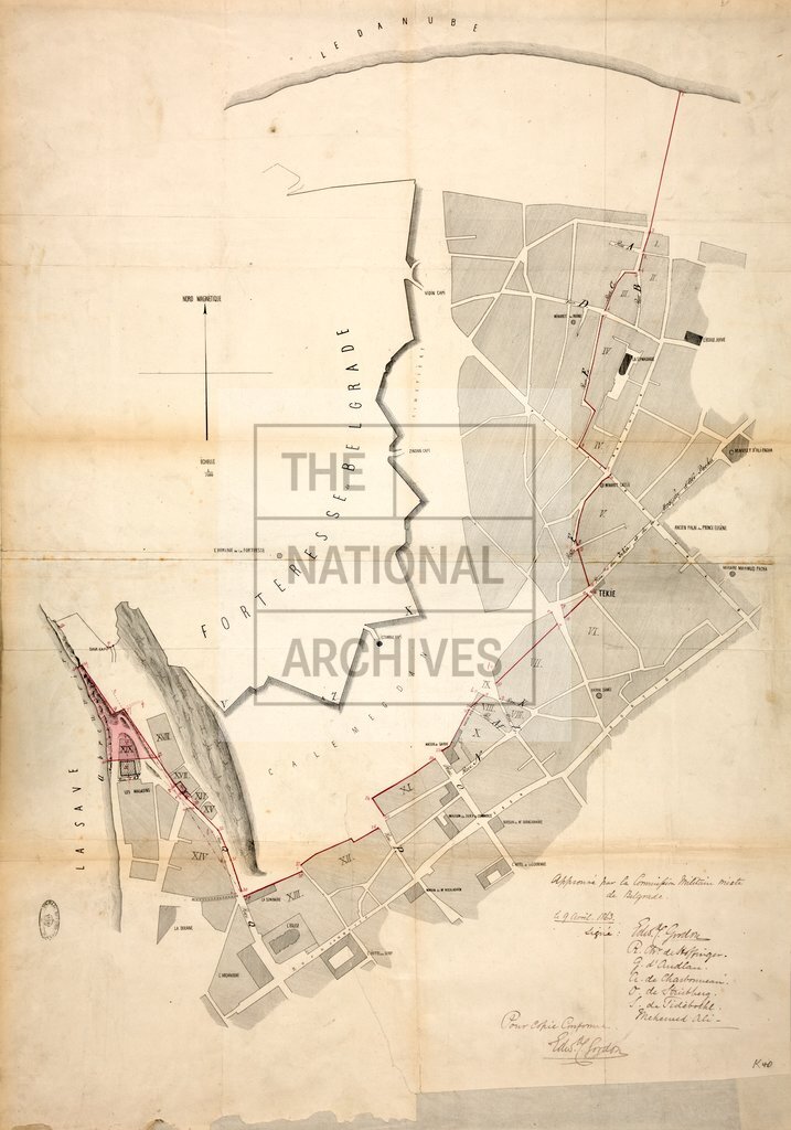
Catalogue context:
1 item extracted from FO 78/1749 . Plan of area south and east of Belgrade, Serbia, showing rivers, fortress, principal buildings, main street names. Compass indicator. Red ink additions. (Signed) E C Gordon, R C de Hoffinger, G d'Audlan, A de Charbonneau, O de Strübberg, S de Tideborhl and Mehemed Ali [members of the Mixed Military Commission on the Rayon of the Fortress of Belgrade]. Signed by E C Gordon, certifying this to be a true copy of the map referred to in 'Rapport à la Sublime Porte de la Commission militaire mixte sur le tracé du nouveau Périmètre de l'Esplanade de la Forteresse de Belgrade', a copy of which he enclosed in despatch no 8 of 9 April 1863 to Sir Henry Bulwer.
Categories:
Maps and plans
Subjects:
Archives and libraries; Europe and Russia; International; Maps and plans; Operations, battles and campaigns
Topics:
International trade and affairs; Land and buildings; Military and war
Period:
Victorians
Copyright information:
Copyright clearance for publication is not required, except in the case of documents in third-party copyright.
Usage terms:
https://www.nationalarchives.gov.uk/documents/information-management/use-of-tna-materials.pdf