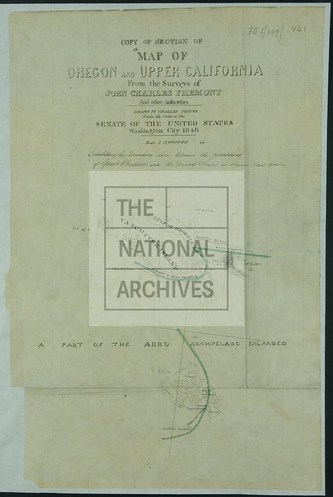
Oregon and Upper California from the Surveys of John Charles Fremont and other Authorities
Date:
1854
Reference:
MPK 1/77 (8)
Creator:
Maps and plans extracted to flat storage from records of the Foreign Office
Catalogue context:
9 items extracted from FO 5/809 (folios 228, 229 and 231 respectively). Four tracings of maps relating to the boundary between the United States of America and British Columbia. Transmitted to the Foreign Office by the Colonial Office. Detailed descriptions are given at item level.
Categories:
Maps and plans
Subjects:
Americas; Archives and libraries; International; Maps and plans
Topics:
International trade and affairs; Land and buildings
Period:
Victorians
Copyright information:
Copyright clearance for publication is not required, except in the case of documents in third-party copyright.
Usage terms:
https://www.nationalarchives.gov.uk/documents/information-management/use-of-tna-materials.pdf