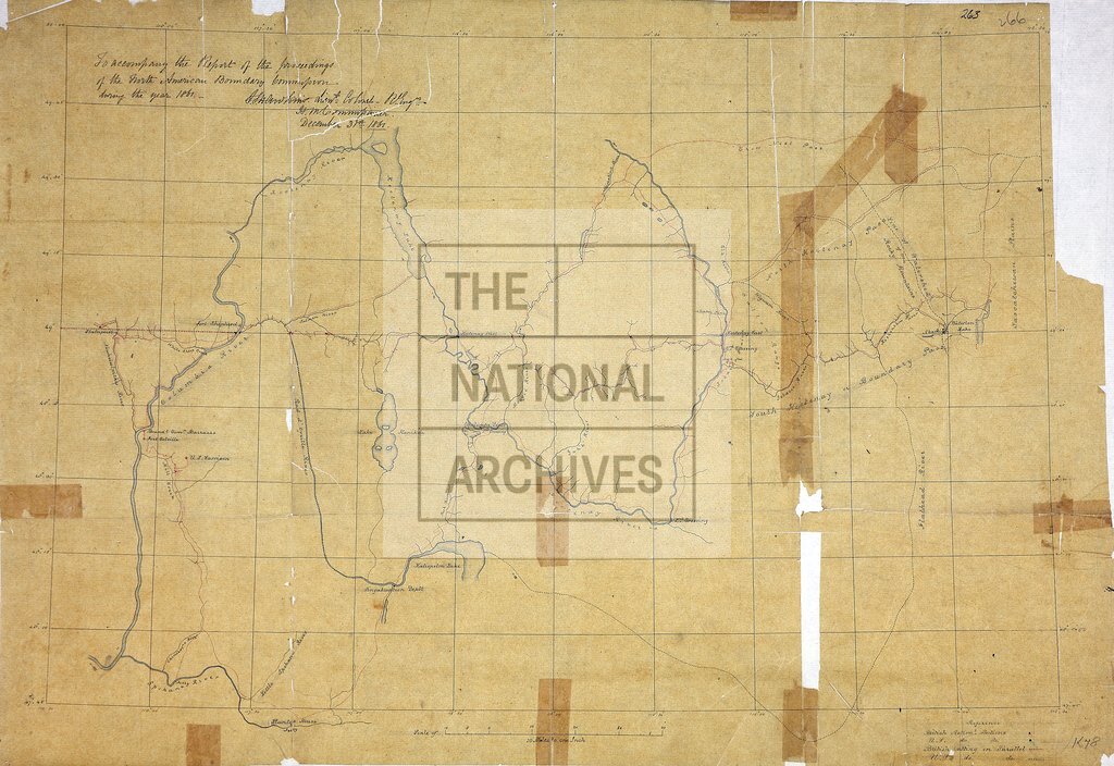
Map of area either side of the boundary between British Columbia and the United States of America
Date:
1861
Reference:
MPK 1/78 (2)
Creator:
Maps and plans extracted to flat storage from records of the Foreign Office
Catalogue context:
1 item (enclosure to despatch no 24 of 31 December 1861) extracted from FO 5/811 (folio 266). Map of area either side of the boundary between British Columbia and the United States of America: shows rivers, lakes, settlements, passes, crossings, ferries etc between the Columbia River and the Saskatchewan Plains and between 47°47' and 50°N. Reference table to British and United States astronomical stations. Scale: 1 inch to 10 miles. Signed by J S Hawkins, Lt Col RE, British Commissioner, 31 December 1861. Drawn to accompany report of proceedings of the North American Boundary Commission during 1861.
Categories:
Maps and plans
Subjects:
Americas; Archives and libraries; International; Litigation; Maps and plans
Topics:
Crime, courts and justice; International trade and affairs; Land and buildings
Period:
Victorians
Copyright information:
Copyright clearance for publication is not required, except in the case of documents in third-party copyright.
Usage terms:
https://www.nationalarchives.gov.uk/documents/information-management/use-of-tna-materials.pdf