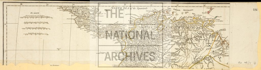
South and Central America, showing Terra Firma
Date:
1791
Reference:
MPK 1/203/1
Creator:
Maps and plans extracted to flat storage from records of the Foreign Office
Catalogue context:
South and Central America. Map showing 'Tierra Firma' (now British Guiana, Colombia and Venezuela) and part of New Spain (now Costa Rica, Nicaragua and Panama); the area is from approximately 13°N to 2°N. Scale: 1 inch to about 125 miles. Marked (on reverse): 'With Mr. Williamson's plan received in the beginning of 1791'.
Categories:
Maps and plans
Subjects:
Americas; Archives and libraries; Europe and Russia; International; Maps and plans
Topics:
International trade and affairs; Land and buildings
Period:
Empire And Industry
Copyright information:
Copyright clearance for publication is not required, except in the case of documents in third-party copyright.
Usage terms:
https://www.nationalarchives.gov.uk/documents/information-management/use-of-tna-materials.pdf