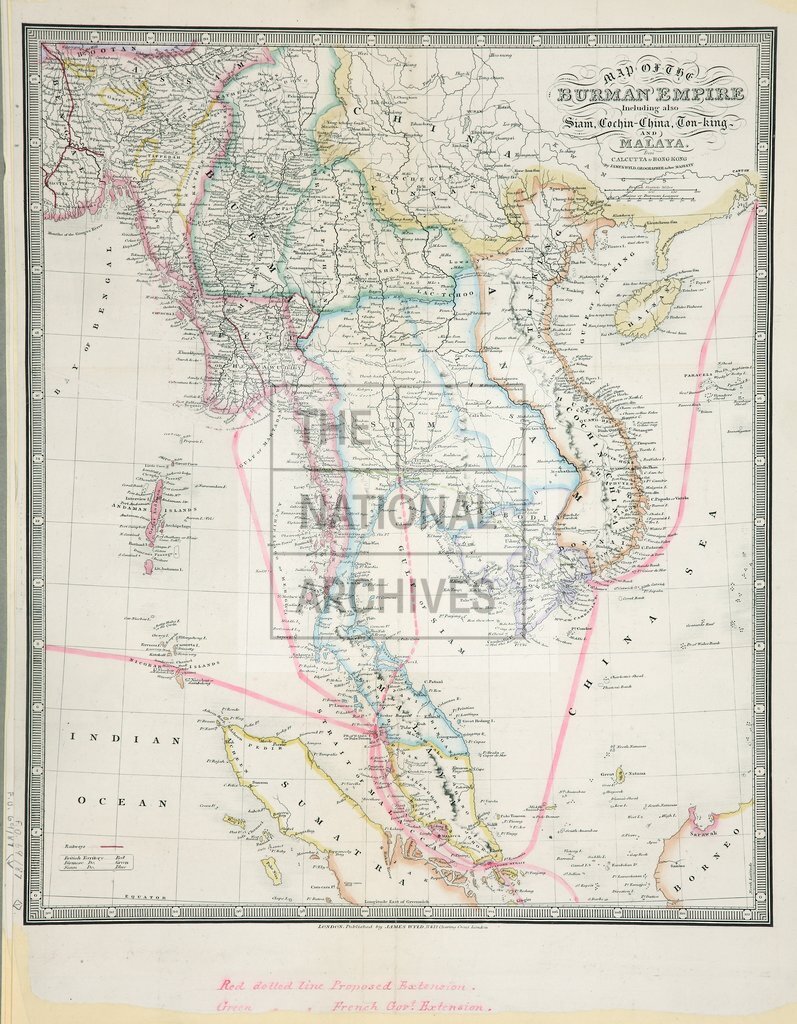
Map of The Burman Empire
Date:
1879
Reference:
MPK 1/219 (1)
Creator:
Maps and plans extracted to flat storage from records of the Foreign Office
Catalogue context:
4 items (enclosures to letter from Mr Pender MP to Mr Sanderson, 2 January 1883) extracted from FO 69/87 . South-East Asia. 'Map of the Burman Empire. Including also Siam, Cochin-China, Ton-King and Malaya. From Calcutta to Hong Kong. By James Wyld, Geographer to Her Majesty': (these areas are now in Malaysia, Myanmar, Thailand and Vietnam); 4 copies, showing political and ethnic boundaries; proposed and existing telegraph cables, and land lines. Reference tables. Scale: 4.2 cm to 200 miles [1 inch to about 120 miles]. Published by Jamed Wyld, London. MS additions, coloured, (different on each sheet) to items 2-4.
Categories:
Maps and plans
Subjects:
Archives and libraries; Asia; Communications; Indian Subcontinent; International; Maps and plans; Race relations
Topics:
Arts and culture; British state and citizens; International trade and affairs; Land and buildings
Period:
Victorians
Copyright information:
Copyright clearance for publication is not required, except in the case of documents in third-party copyright.
Usage terms:
https://www.nationalarchives.gov.uk/documents/information-management/use-of-tna-materials.pdf