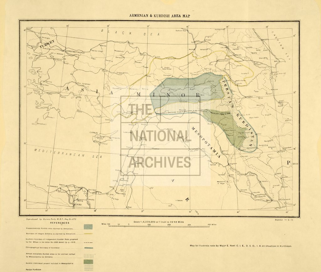
Armenian and Kurdish area with the proposed southern boundary of an independent Kurdish state
Date:
1919
Reference:
MPK 1/292 (1)
Creator:
Maps and plans extracted to flat storage from records of the Foreign Office
Catalogue context:
2 items extracted from FO 608/95 . South-West Asia. 2 maps showing parts of the Middle East and the Caucasus. (1) 'Armenian and Kurdish Area Map': showing the proposed southern boundary of an independent Kurdish state, as outlined in a letter by Colonel Wilson, 13 June 1919; state and ethnic boundaries indicated. Scale: 1 inch to 94.68 miles to an inch. Reproduced by Survey Party M E F Reference number 473. Produced to illustrate note by Major Noel on the situation in the Kurdish area. (2) Sheet made from parts of two GSGS maps, one of the Erzerum area ('J37') and the other of the Tabriz area ('J38': GSGS 2555) cut down and joined: together showing the area between Urfa (now Sanilurfa, Turkey) and Urmia (now Orumiyeh, Iran); marking roads, boundaries, post and telegraph offices, and relief. Reference table. Scale: 1 inch to 15.78 miles. Compiled at the Royal Geographical Society; drawn and printed at the War Office 1916; revised to Oct 1918. MS additions, coloured, show the boundaries of areas labelled as...
Categories:
Maps and plans
Subjects:
Archives and libraries; Armed Forces (General Administration); Army; Asia; Communications; Conflict; International; Maps and plans; Middle East; Operations, battles and campaigns; Race relations
Topics:
Arts and culture; British state and citizens; International trade and affairs; Land and buildings; Military and war
Period:
Interwar
Copyright information:
Copyright clearance for publication is not required, except in the case of documents in third-party copyright.
Usage terms:
https://www.nationalarchives.gov.uk/documents/information-management/use-of-tna-materials.pdf