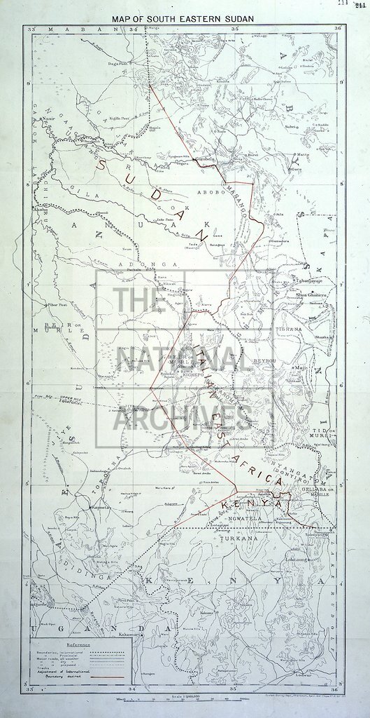
South Eastern Sudan, showing boundaries with Abyssinia and Kenya
Date:
1937-1938
Reference:
MPK 1/359 (2)
Creator:
Maps and plans extracted to flat storage from records of the Foreign Office
Catalogue context:
4 items extracted from FO 371/22017 . Maps of parts of east Africa. Detailed descriptions are given at item level.
Categories:
Maps and plans; Overseas
Subjects:
Africa; Archives and libraries; International; Maps and plans
Topics:
International trade and affairs; Land and buildings
Period:
Interwar
Places:
Africa; Kenya
Copyright information:
Copyright clearance for publication is not required, except in the case of documents in third-party copyright.
Usage terms:
https://www.nationalarchives.gov.uk/documents/information-management/use-of-tna-materials.pdf