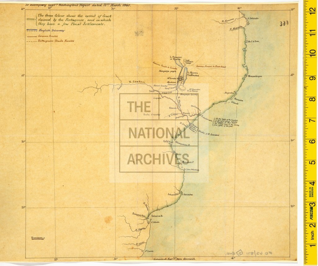
Copy of Dr David Livingstone's map of British discoveries in Malawi and Mozambique
Date:
1860
Reference:
MPK 1/422 (2)
Creator:
Maps and plans extracted to flat storage from records of the Foreign Office
Catalogue context:
2 items extracted from FO 63/871. East Africa. 2 versions of a sketch map of the area (now in Malawi) southwards from about 13° 20' S as far as the Tete area, the Zambesi delta and Quelimane (now in Mozambique), showing the British discoveries of the Shire River, Lakes Chirwa and Nyasa, and the mouths of the Zambezi River; the Portuguese trade route along the Rivers Zambezi and Quelimane; caravan routes to Londa [?Luanda] and to ports on the east coast. (2) Captain Washington's report, 31 March 1860. (2) also shows the extent of coast claimed by the Portuguese and on which they had a few penal settlements. Reference table. Scale: 1 inch to about 110 miles. A later copy on tracing paper. 30 cm x 32 cm
Categories:
Maps and plans
Subjects:
Africa; Archives and libraries; International; Maps and plans; Trade and commerce
Topics:
International trade and affairs; Land and buildings
Period:
Victorians
Copyright information:
Copyright clearance for publication is not required, except in the case of documents in third-party copyright.
Usage terms:
https://www.nationalarchives.gov.uk/documents/information-management/use-of-tna-materials.pdf