Syria, Jaffa, Damascus
Date:
1916
Reference:
MPKK 1/66
Creator:
Maps and plans extracted to extra large flat storage from records of the Foreign Office
Catalogue context:
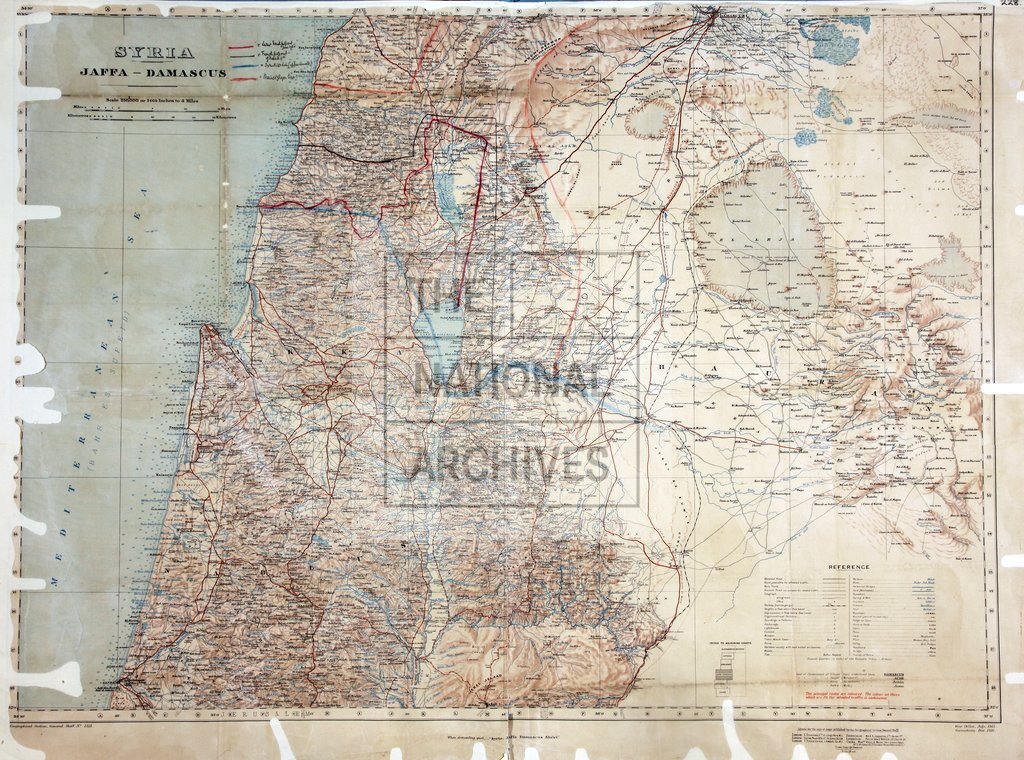
1 item (originally accompanying a letter, 30 June 1920) extracted from FO 371/5244 (folio 156). Middle East. 'Syria, Jaffa, Damascus': map. [By] War Office, July 1915; corrections to December 1916. MS additions, coloured, showing the Syrian boundaries of Palestine in a French proposal of June 1920, a French proposal of 11 March 1920, the Sykes-Picot line and the Meinertzhagen line; additions made June 1920. The area shown is now mostly in Israel, Jordan, the West Bank and Syria.
Categories:
Maps and plans
Subjects:
Archives and libraries; Armed Forces (General Administration); Army; Conflict; International; Maps and plans; Middle East; Operations, battles and campaigns
Topics:
International trade and affairs; Land and buildings; Military and war
Period:
Early 20th Century
Copyright information:
Copyright clearance for publication is not required, except in the case of documents in third-party copyright.
Usage terms:
https://www.nationalarchives.gov.uk/documents/information-management/use-of-tna-materials.pdf