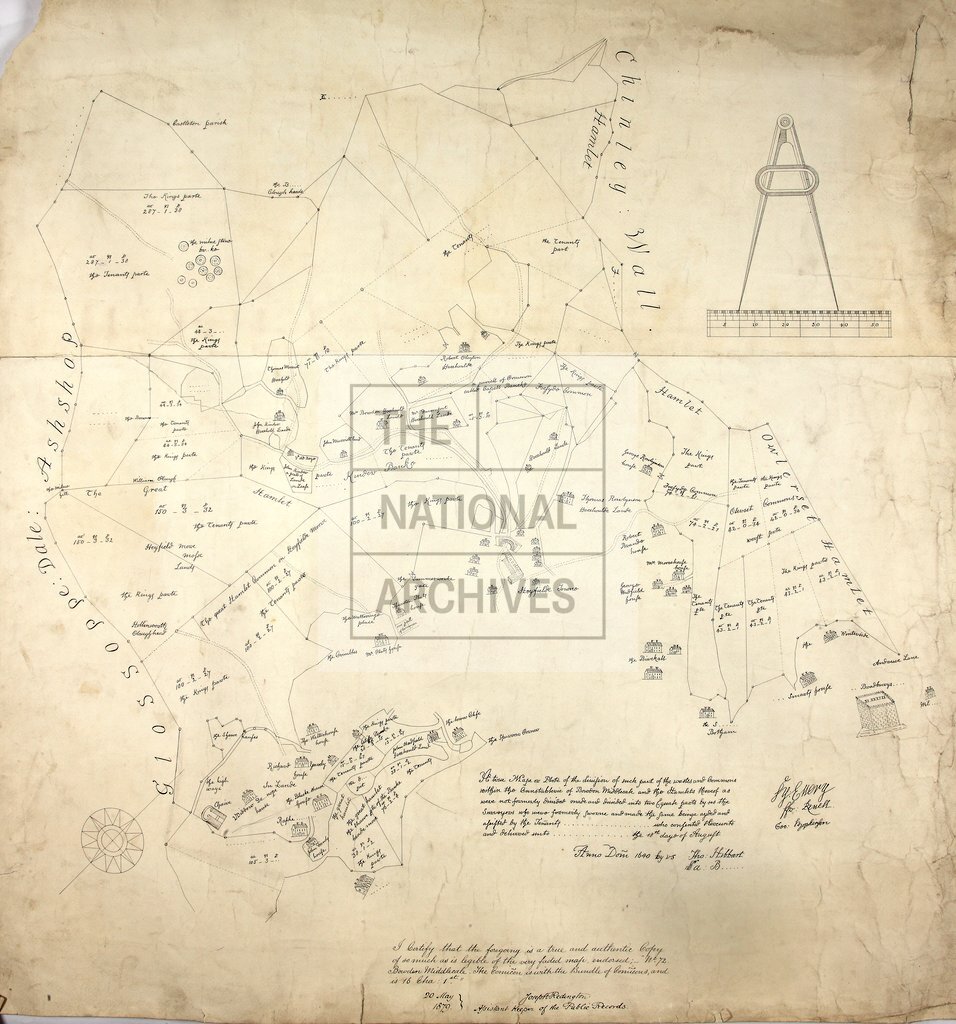
Chinley, Buxworth and Brownside, Derbyshire
Date:
1640
Reference:
MR 1/10
Creator:
Maps and plans extracted to rolled storage from records of various departments
Catalogue context:
Map of Chinley, Buxworth and Brownside, in Derbyshire. Shows division of the wastes and commons of Hayfield with Ollersett (in New Mills) and Chinley Wall hamlets, within the Constabulary of Bowden Middlecale. Also shows acreage, names of proprietors, and houses in perspective. Scale bar surmounted by dividers; 1 inch to about 5 chains. Drawn by Thomas Hibbart and Samuel [Barton], surveyors, 18 August 1640. With parchment commission and return, and an office copy certified by Joseph Redington, Assistant Keeper of Public Records, 20 May 1879.
Categories:
Maps and plans
Subjects:
Archives and libraries; Maps and plans
Topics:
Land and buildings
Period:
Early Modern
Copyright information:
Copyright clearance for publication is not required, except in the case of documents in third-party copyright.
Usage terms:
https://www.nationalarchives.gov.uk/documents/information-management/use-of-tna-materials.pdf