Allerton and Wavertree Manors, Lancashire, [1568]
Date:
1568
Reference:
MR 1/11
Creator:
Maps and plans extracted to rolled storage from records of various departments
Catalogue context:
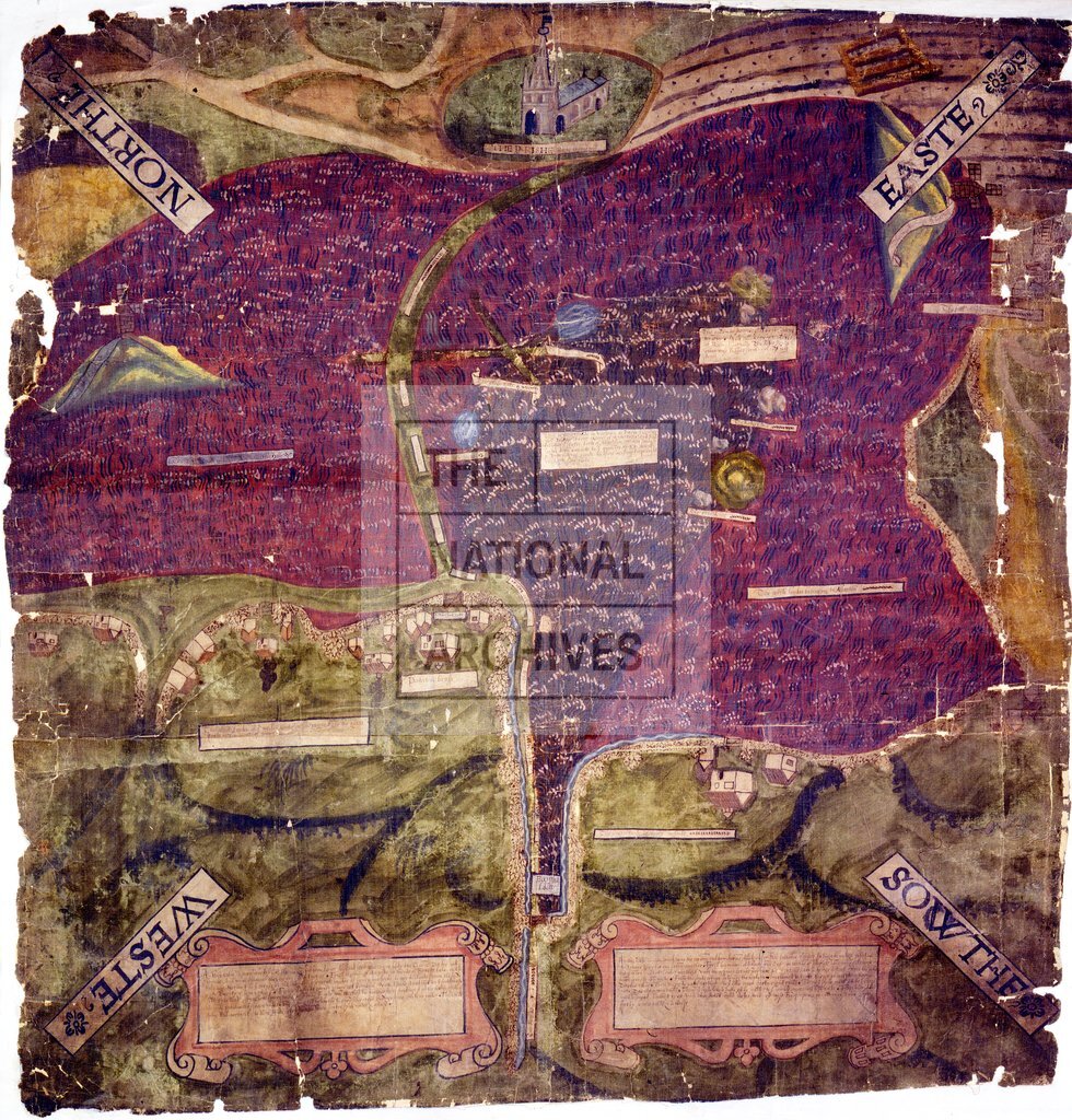
Map of Allerton and Wavertree manors, Lancashire: shows wasteland, commons, fields, hedges, lanes, hills, meres, named stones, cross. Childwall church, two post windmills on large mounds, houses, gates, in simple perspective. Legends within labels. Two fretwork cartouches within which the boundaries of the two manors are set out. No scale shown. Cardinal points in labels decorated with flowers. Oriented to the north-east. Endorsement in late seventeenth-century hand: 'No. 73 Wavertree The Comicion Interrogatorys and Depeosicions are with the bundle of Comicions And are 10th Elizabeth'. For the petition from Sir Richard Molyneux, steward of the Duchy of Lancaster manor of Wavertree, and Richard Lathorne, owner of the manor of Allerton, asking for the joint boundaries of the manors to be ascertained, see DL 1/60 , M 15. For the commission ordering the making of the map, dated 30 May, 10 Elizabeth, and the commissoners' return, see DL 44/169
Categories:
Maps and plans
Subjects:
Archives and libraries; Crown lands and estates; Manors; Maps and plans; Religions
Topics:
Religion; Land and buildings
Period:
Early Modern
Copyright information:
Copyright clearance for publication is not required, except in the case of documents in third-party copyright.
Usage terms:
https://www.nationalarchives.gov.uk/documents/information-management/use-of-tna-materials.pdf