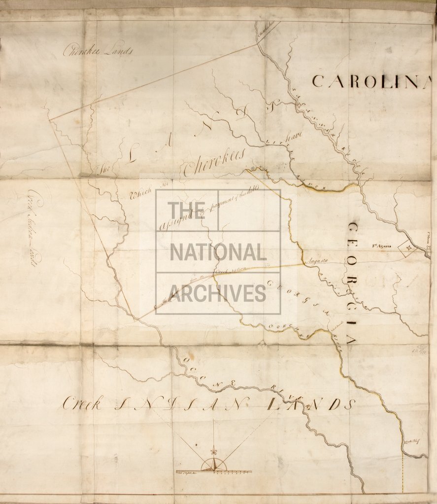
Area to the south of the Savannah River, showing the Ogeechee and Oconee Rivers, Briar Creek, Creek and Cherokee lands, Georgia
Date:
1772
Reference:
MR 1/18
Creator:
Maps and plans extracted to rolled storage from records of various departments
Catalogue context:
1 item (enclosure to letter from John Stuart, 13 June 1772) extracted from CO 5/73 (folio 321). North America: Georgia (now part of the United States of America). Map of an area to the south of the Savannah River, showing the Ogeechee and Oconee Rivers, Briar Creek, Creek and Cherokee lands, lands assigned by the Cherokee for the payment of debts, the Creek Road to Augusta, and place names. Scale: 1 inch to about 3.25 miles. Compass indicator. Made under Stuart's direction.
Categories:
Maps and plans
Subjects:
Americas; Archives and libraries; Debt; Europe and Russia; Maps and plans
Topics:
Business, finance and innovation; International trade and affairs; Land and buildings
Period:
Empire And Industry
Copyright information:
Copyright clearance for publication is not required, except in the case of documents in third-party copyright.
Usage terms:
https://www.nationalarchives.gov.uk/documents/information-management/use-of-tna-materials.pdf