Island of Castle William near Boston, Massachusetts
Date:
1771
Reference:
MR 1/19
Creator:
Maps and plans extracted to rolled storage from records of various departments
Catalogue context:
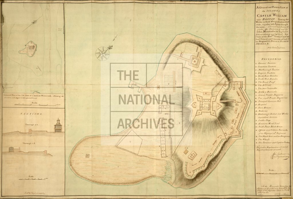
1 item extracted from CO 5/89 (folios 71-72). North America: Massachusetts (now part of the United States of America). 'A General and Particular Plan of the Island of Castle William near Boston, shewing the Works in their Original and present state, together with Sections through the same ....'. Reference table to defence works, batteries and buildings. Scale: 1 inch to 50 feet [1:600] (plan); 1 inch to 20 feet [1:240] (sections). Compass rose. By Captain Lieutenant John Montresor, Engineer Extraordinary; by order of Lieutenant General Thomas Gage, Commander-in-Chief. Inset: 'General Plan of the Island....Shewing its situation with respect to the adjacent islands'; scale: 1 inch to 160 yards.
Categories:
Maps and plans
Subjects:
Americas; Archives and libraries; Maps and plans
Topics:
International trade and affairs; Land and buildings
Period:
Empire And Industry
Copyright information:
Copyright clearance for publication is not required, except in the case of documents in third-party copyright.
Usage terms:
https://www.nationalarchives.gov.uk/documents/information-management/use-of-tna-materials.pdf