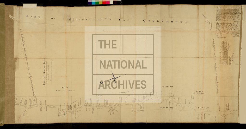
Part of Hudson's River from the Half Moon to Magdalane's Island
Date:
1773
Reference:
MR 1/20
Creator:
Maps and plans extracted to rolled storage from records of various departments
Catalogue context:
1 item extracted from CO 5/1104 (folios 581-582). North America: New York Colony (now New York State, United States of America). 'Part of Hudson's River from the Half Moon to Magdalane's Island ...': map, also showing the Mohawk River, other rivers, place names, land proprietors' names, churches, manors and boundaries. Scale: 1 inch to 1 mile. Compass indicator. Partly surveyed by Robert Yates and Jeremiah Van Renselaer; drawn by C J Sauthier.
Categories:
Maps and plans
Subjects:
Americas; Archives and libraries; Manors; Maps and plans; Religions
Topics:
International trade and affairs; Land and buildings; Religion
Period:
Empire And Industry
Copyright information:
Copyright clearance for publication is not required, except in the case of documents in third-party copyright.
Usage terms:
https://www.nationalarchives.gov.uk/documents/information-management/use-of-tna-materials.pdf